I LOVE ZION NATIONAL PARK! This is the park by which I compare all other parks and every other one fails compared to here. I’ve been so many times because I lived about an hour away. But it is worth traveling across the country to get to.
Scenic Drive – East to West
I always came in at the East Entrance because of where I lived but a lot of people come in through the West Entrance through Springdale. If that’s the case for you, read this post backwards, I guess.
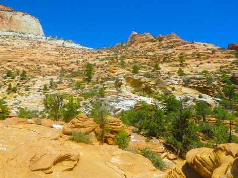
First of all, driving through Zion the first time is dangerous. We almost crashed the car loads of times because we were looking up at everything. And the road is all twisty with fallen rocks you have to avoid. Imagine playing Mario Kart and being distracted by the visuals. So I recommend getting out and looking every so often until you become acclimated to the amazing-ness.

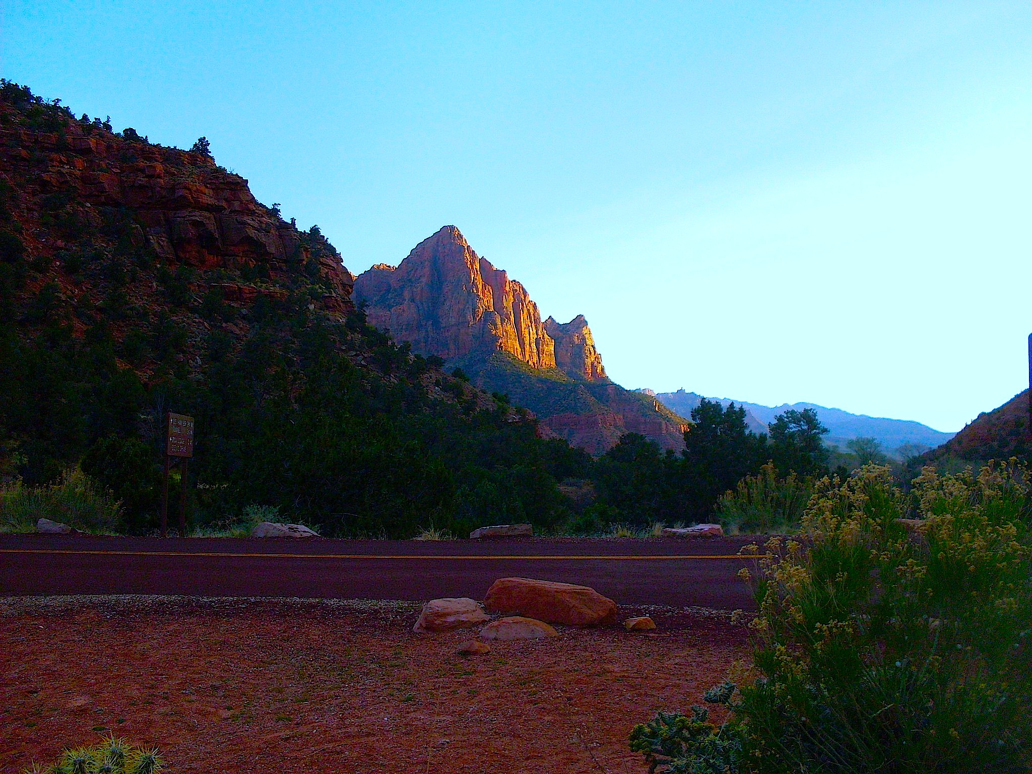
Coming into the park.
At first, driving in it doesn’t look all that spectacular. The first thing you’ll stop at is something called Checkerboard Mesa, which is just a white hill with some lines cut in that KIND OF resemble a checkerboard.
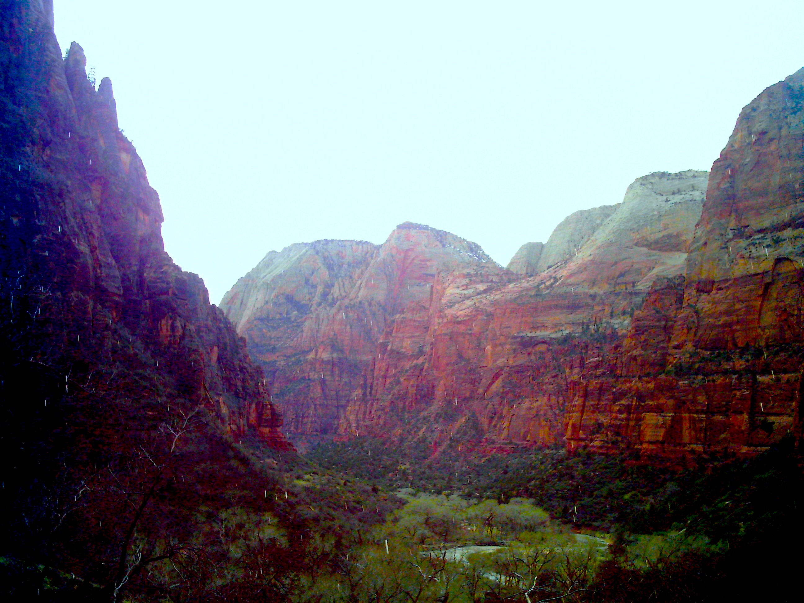
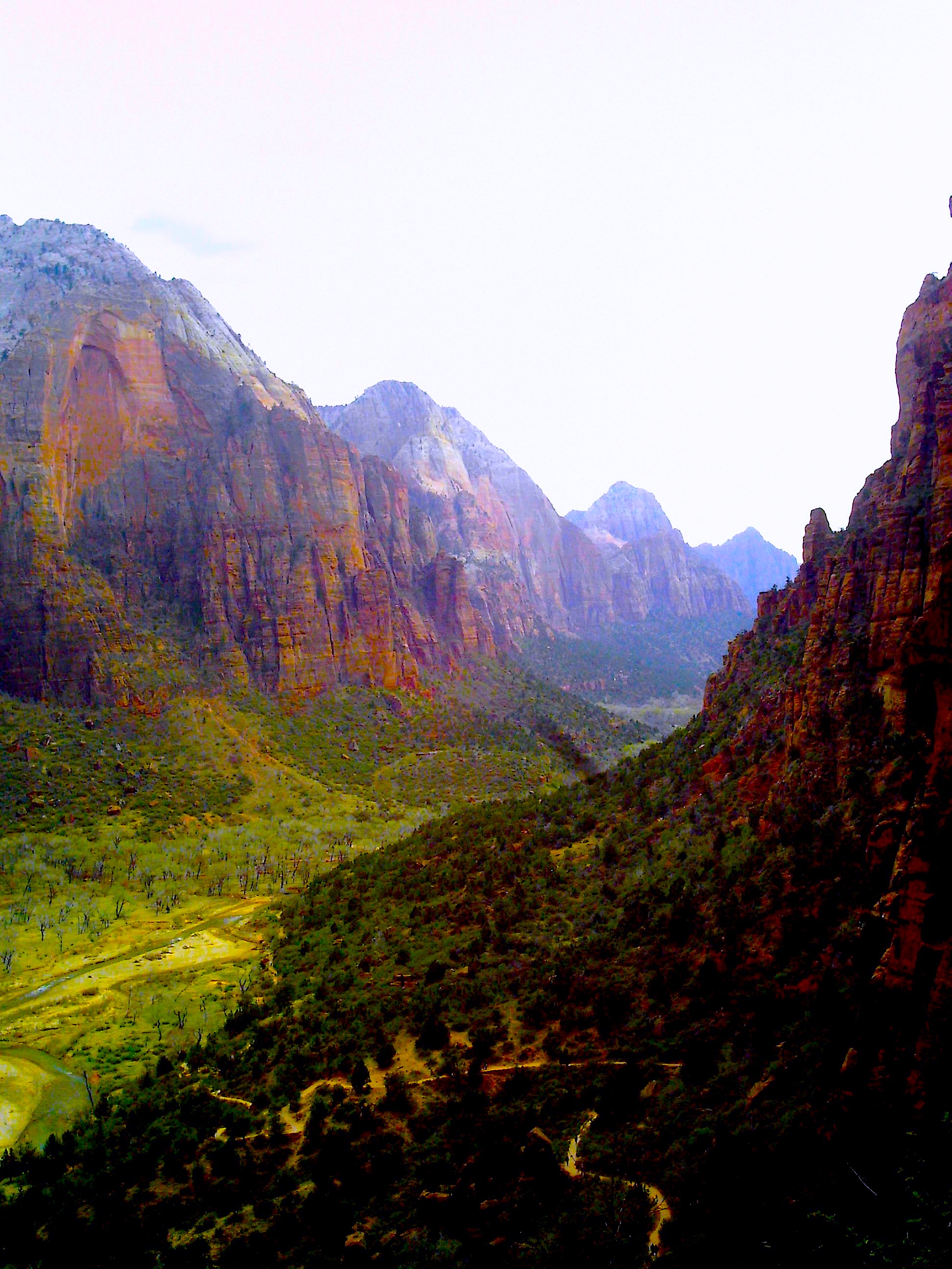
But once you get past that, the park opens up and you are confronted with huge, dark brown cliff walls that push down on you until you realize how insignificant you are in this huge world. It’s the most zen thing I can describe. Instead of being disturbed by how small I felt, I was comforted. I was surrounded by a beauty that is felt more than seen and I was made of the same atoms. I was in Zion National Park, but Zion was also in me. Little problems in my life and insecurities and fears didn’t mean anything because I was beautiful and awe-inspiring and solid and majestic. But I was luckier than this place. Zion National Park must be visited to feel its beauty. I could travel the world with Zion inside me, spreading its beauty wherever I went, if only I remembered it was inside me.

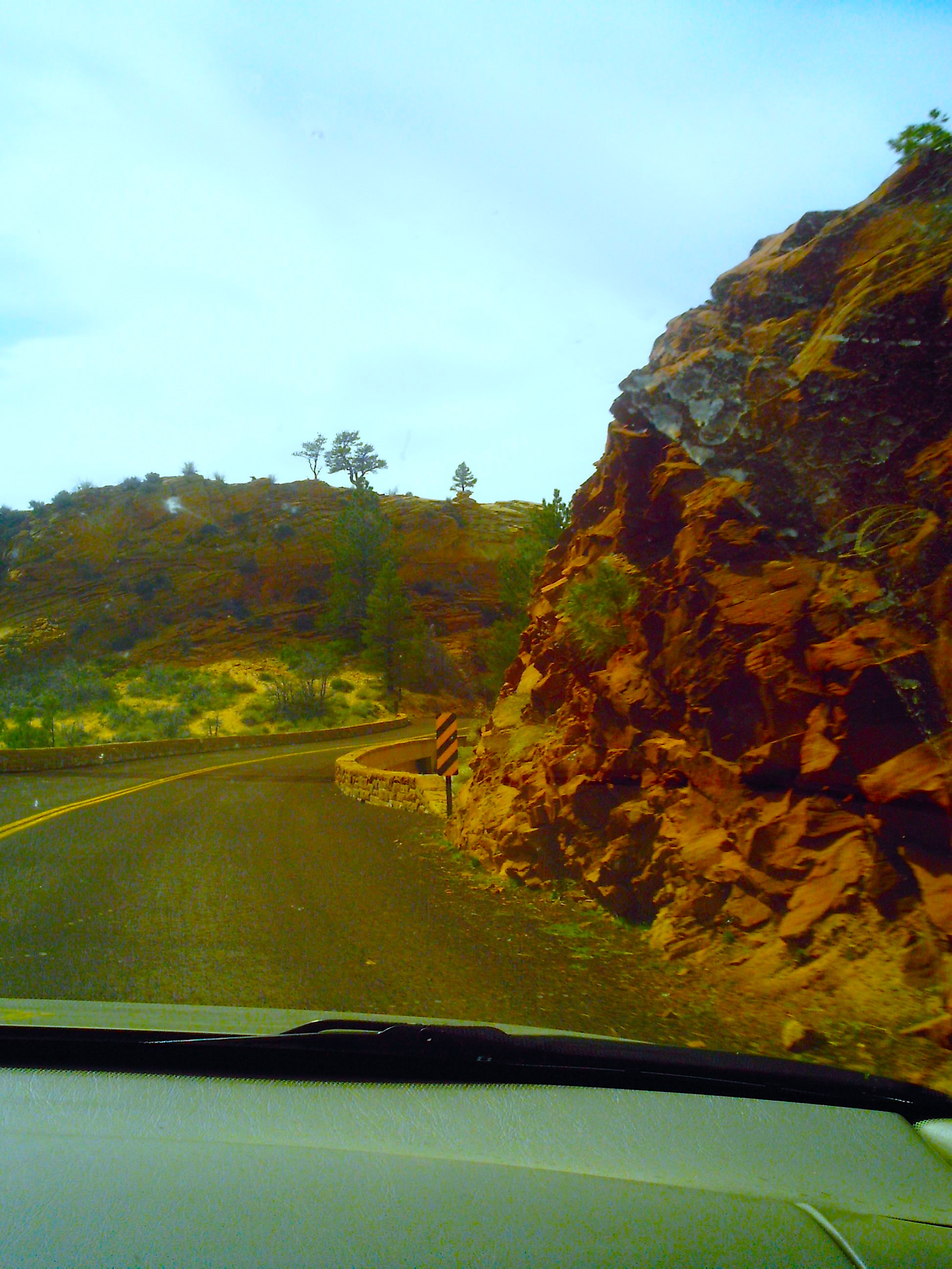
You get so close to the rock walls when you drive.
You can capture expressions of joy and sadness in photographs, but you cannot capture joy or sadness itself. These pictures show rocks and sky, not the joy or awesomeness or love of this place. Zion must be felt and experienced by your entire being, not just your eyes. These pictures just do not do Zion justice.
Ain’t no mountain high enough, ain’t no valley low enough.

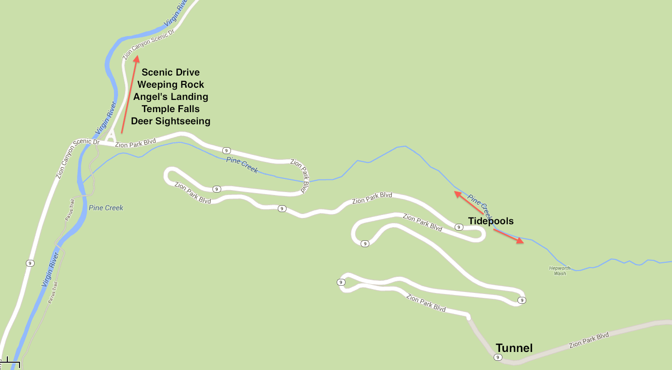
There are two key roads in Zion. The Zion-Mount Carmel Highway cuts through Zion east to west. The other is at the west side of Zion and turns off from the Zion-Mount Carmel Highway and heads northeast. This is the Zion Canyon Scenic Drive. The Zion Canyon Scenic Drive is where you find all the attractions I’ll describe below. Now, on the super busy days, no cars are allowed on the Zion Canyon Scenic Drive. They have a shuttle system. I hate depending on other people for transportation but the shuttle system isn’t actually that bad. It goes from the visitors center, up the Zion Canyon Scenic Drive, stopping at each attraction, and back again. There are plenty of shuttles, it is impossible to get lost because they only go in two directions, and I’ve never waited more than 10 minutes from one. And it’s not like you have to stare at your shoes. If you’re waiting for a shuttle, you can check out the amazing scenery.
I’m telling you all this because, while the Zion Canyon Scenic Drive is more regulated because that’s where the main attractions are, the Zion-Mount Carmel Highway is the exact opposite. There are no parking lots along the way, just small turnoffs that can fit maybe 5 cars. This is where people get out to take pictures or even hike. See, Zion has secrets. There are amazing hidden hikes all around this part of Zion because most people go see the attractions only. But a quick Internet search can help you find them. Just search for ‘hidden hikes at Zion National Park.’
Zion is famous for the Subway and Narrows but those are crowded or you need a permit. Orderville Canyon is a little known slot canyon that rivals the Subway and Narrows but hardly anyone knows about it. Unfortunately, I found out about it after I moved back to Michigan, but by all accounts it is something that isn’t to be missed.

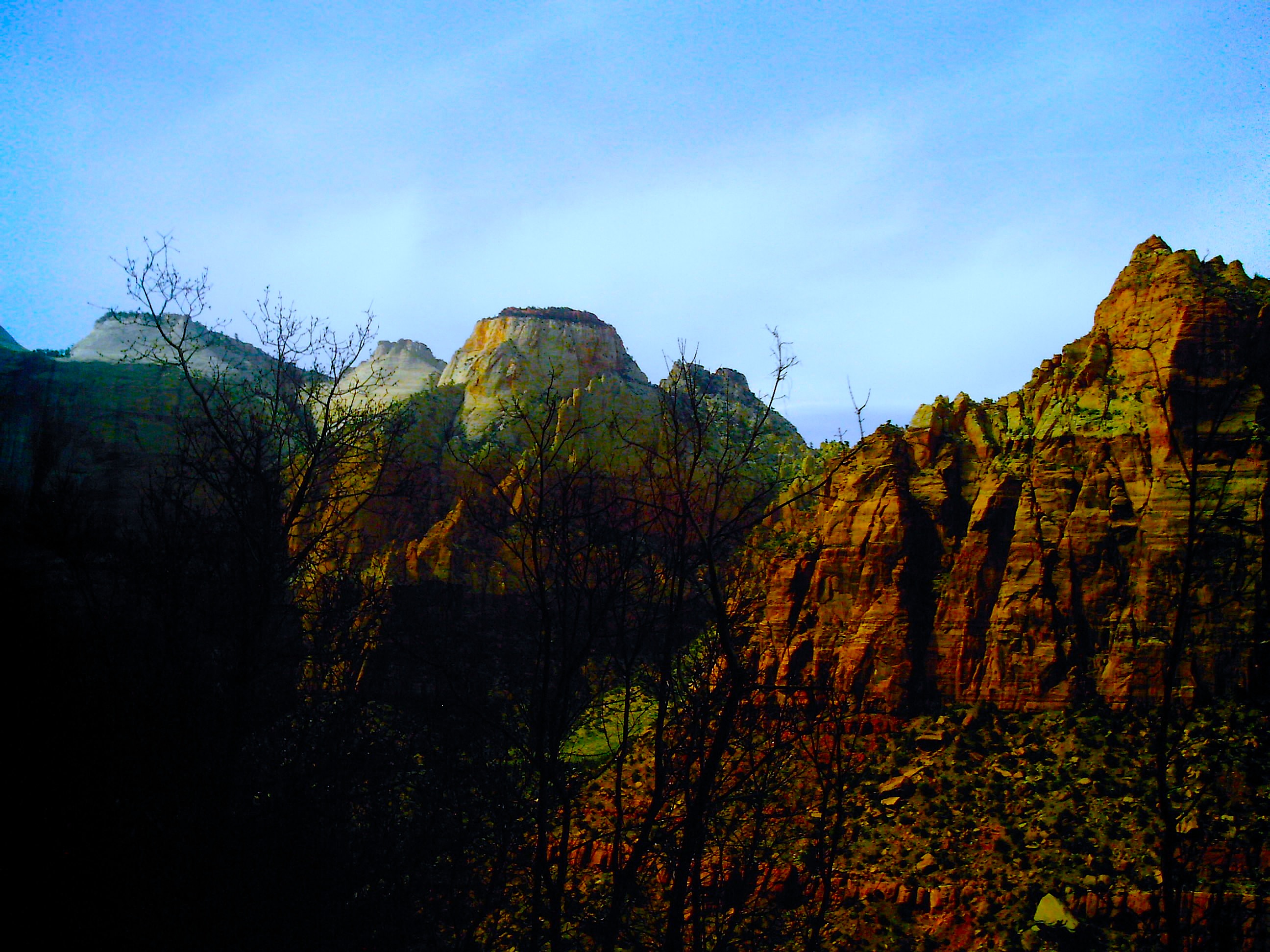
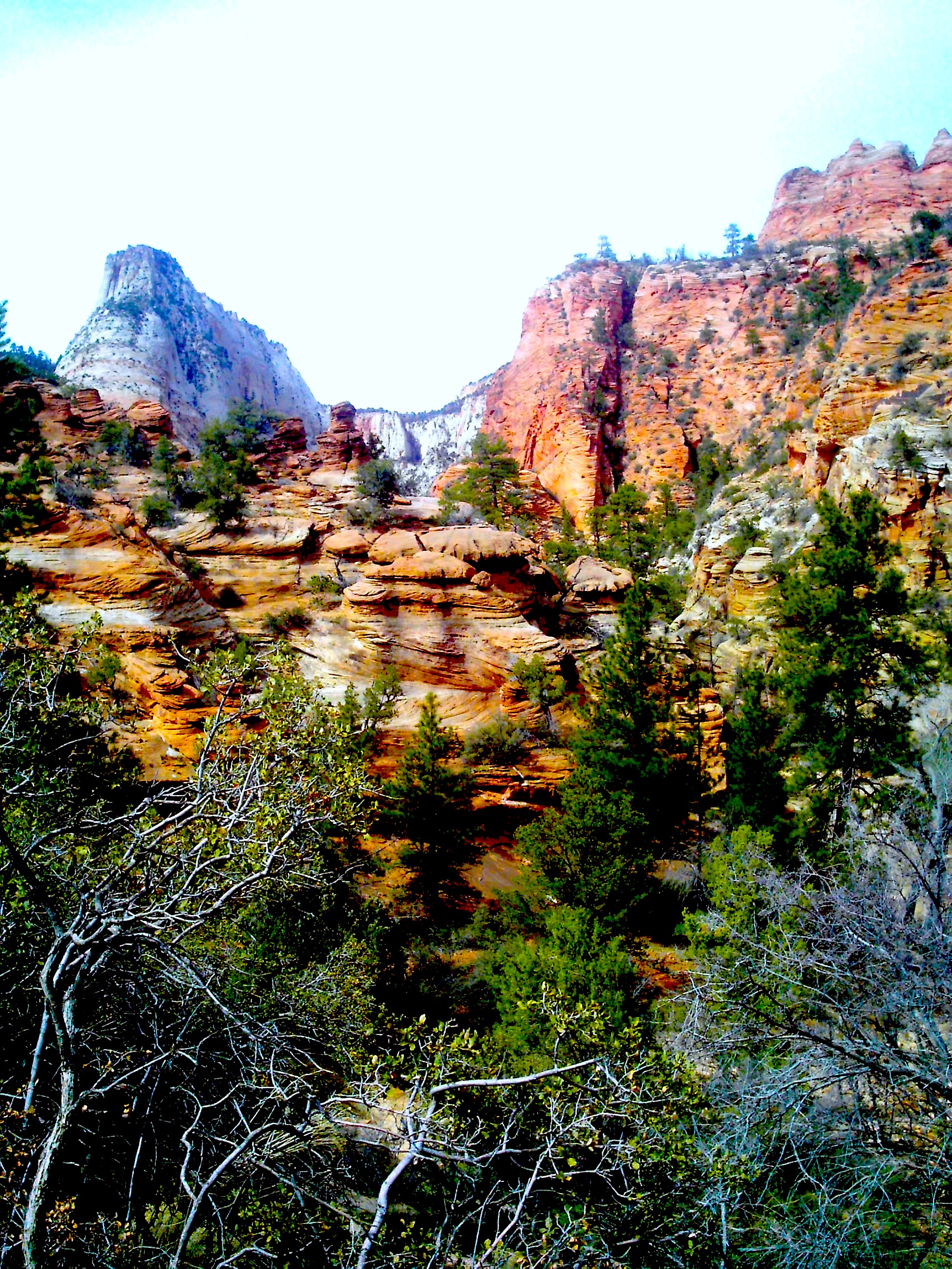
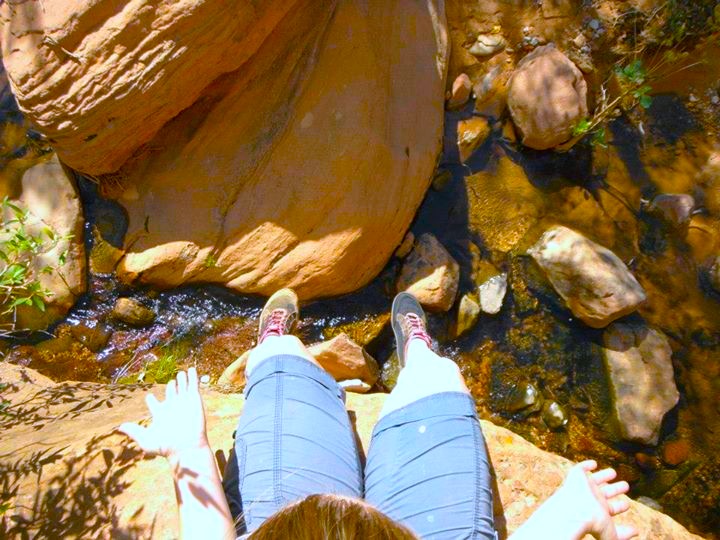
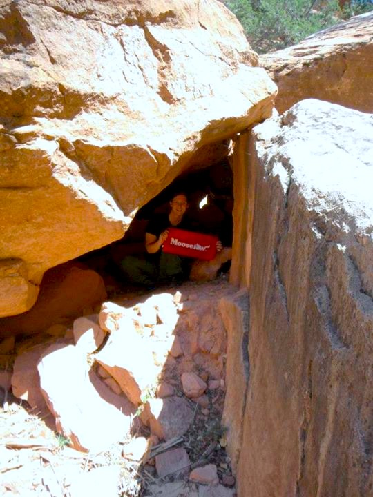
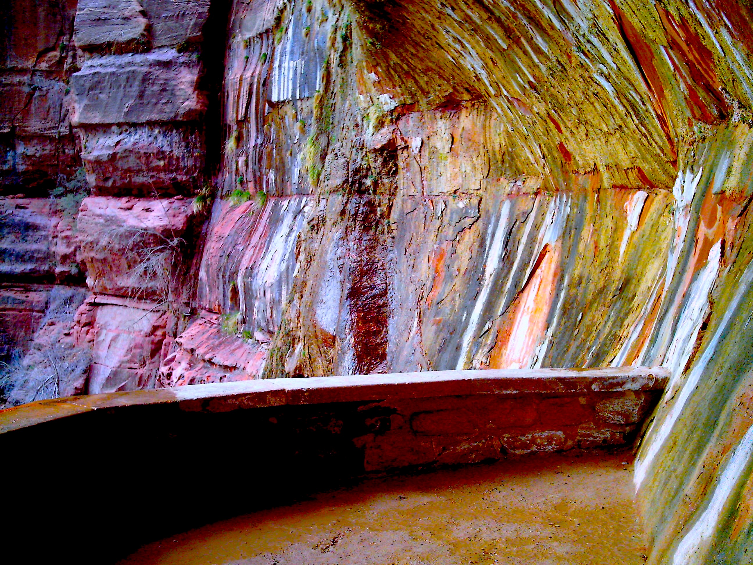
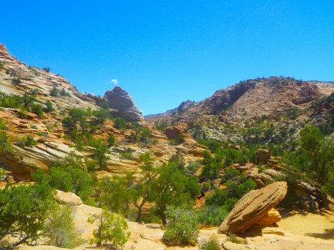
The picture below is taken on the Zion-Mount Carmel Highway. We parked our car on the side of the road and hiked up this little hill thing. Once there, I actually saw some people hiking in the distance. They must have known something I didn’t.
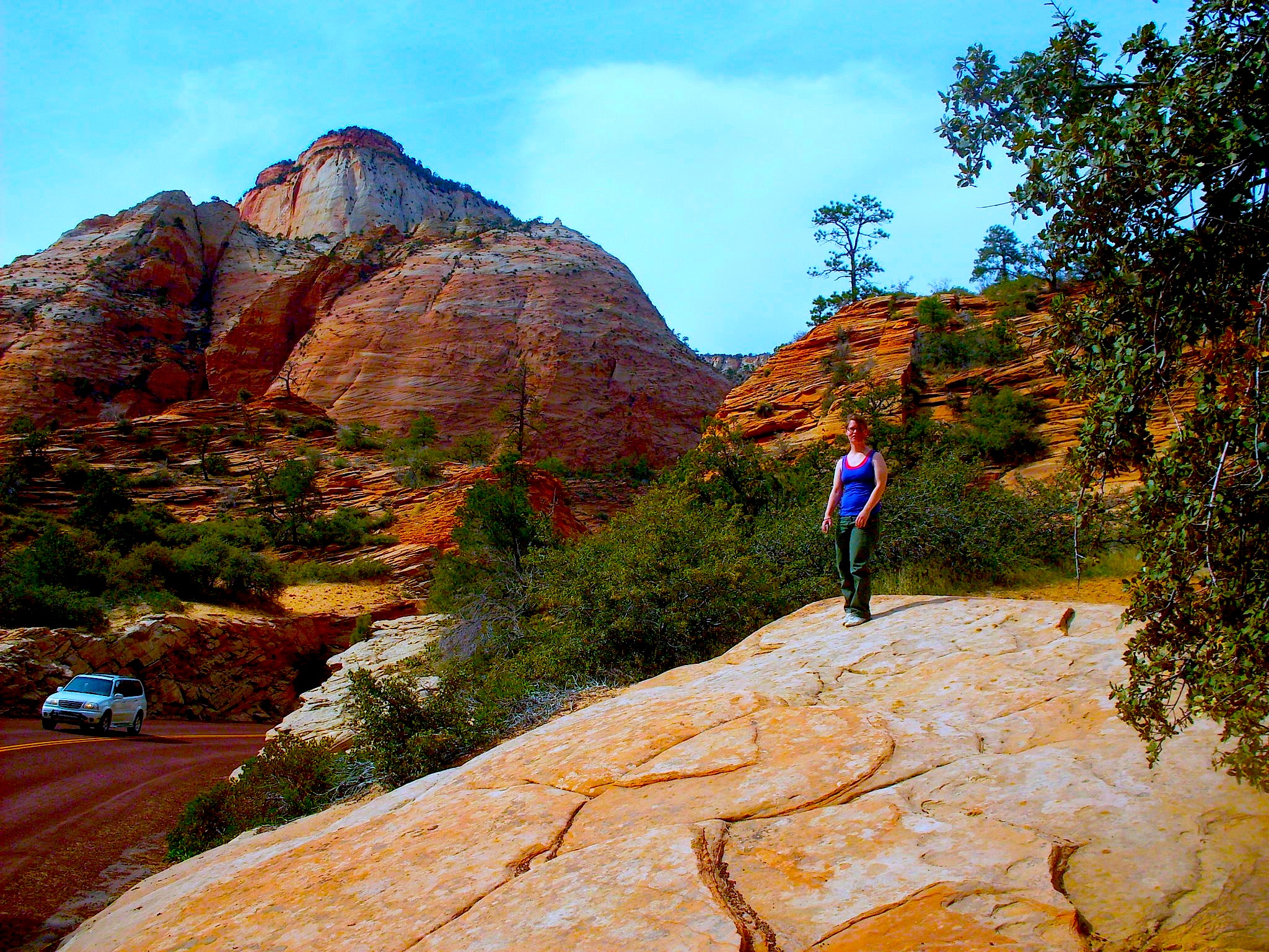
You can park your car on the side of the road and get out and explore.


Gorgeous rock formations tower over you.

Pool of water.

I was so surprised by the amount of green in a desert.
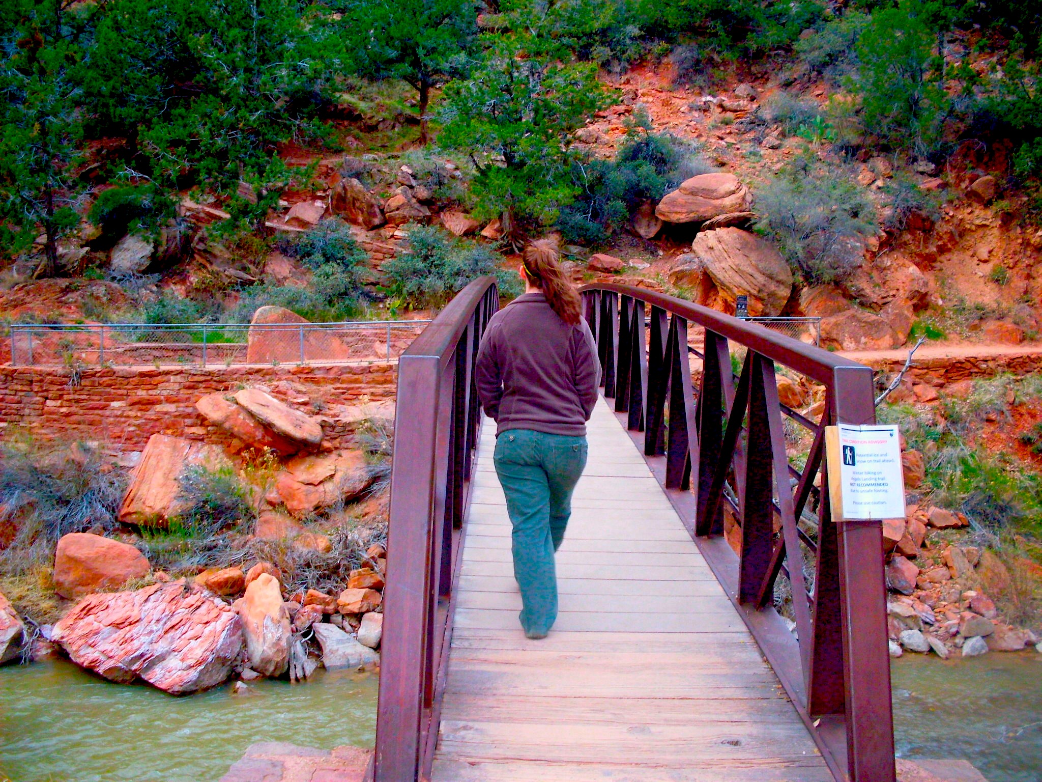
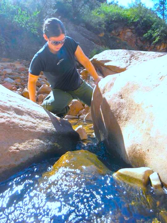
Bridge over a river.

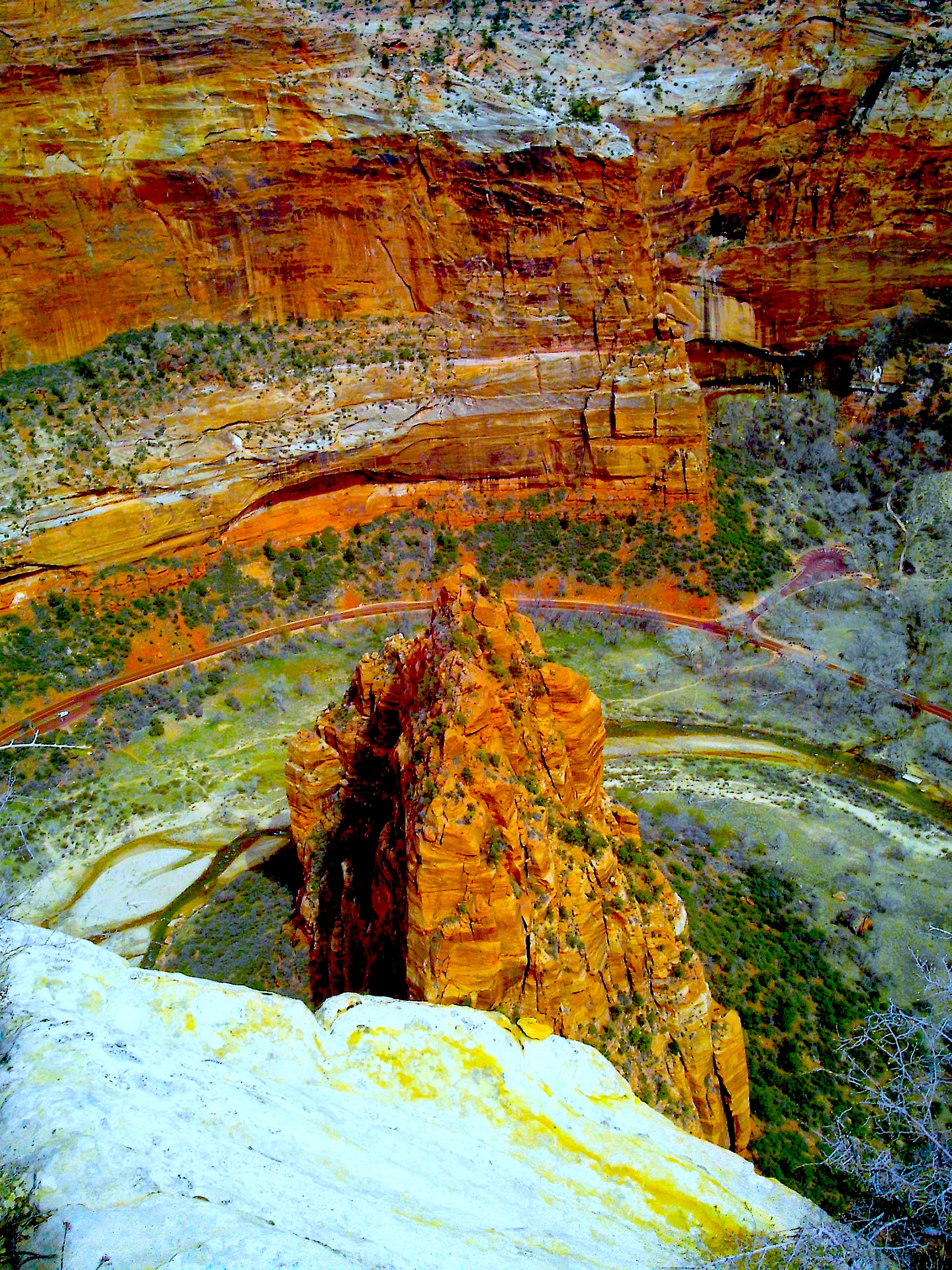
The formations are so tall, they cast shadows on the other rock walls.
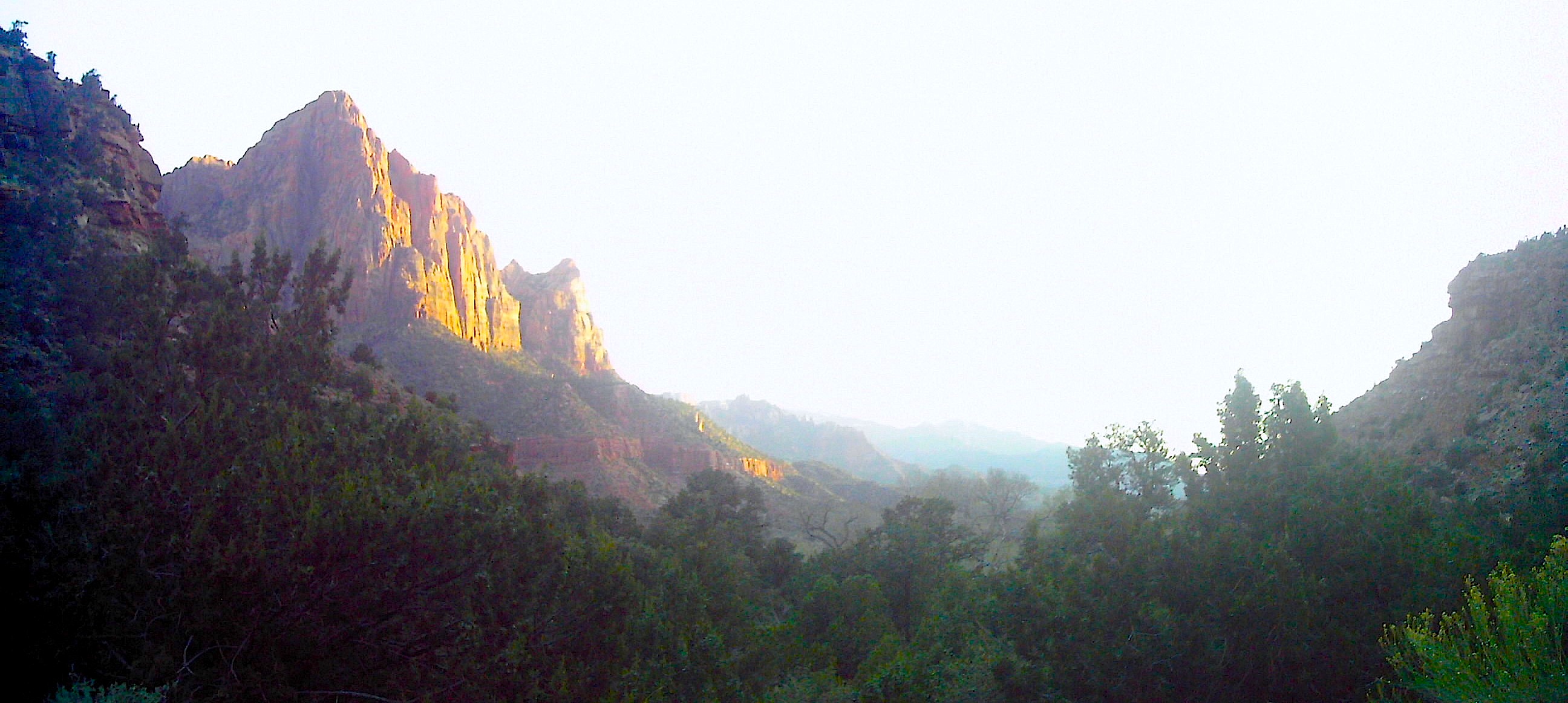
The Tunnel
There is a mile long tunnel through a plateau. And it’s cool. It was started in the late 1920s and finished in 1930. This feat of engineering is not something to be missed. Luckily you can’t. The tunnel is on the Zion-Mount Carmel Highway and if you want to go from one end of the park to the other, you go through this tunnel. If you are coming from Springdale and plan on only seeing the attractions up the Zion Canyon Scenic Drive, I recommend driving down the Zion-Mount Carmel Highway just to go through the tunnel.

Obligatory “don’t go into the light” joke.
There are no lights in the tunnel but there are large windows. Sadly, you can’t stop in the tunnel so any pictures must be taken quickly to be reviewed later. Once, we were lucky and no one was in the tunnel with us so we slowed to the crawliest of crawls and took pictures.
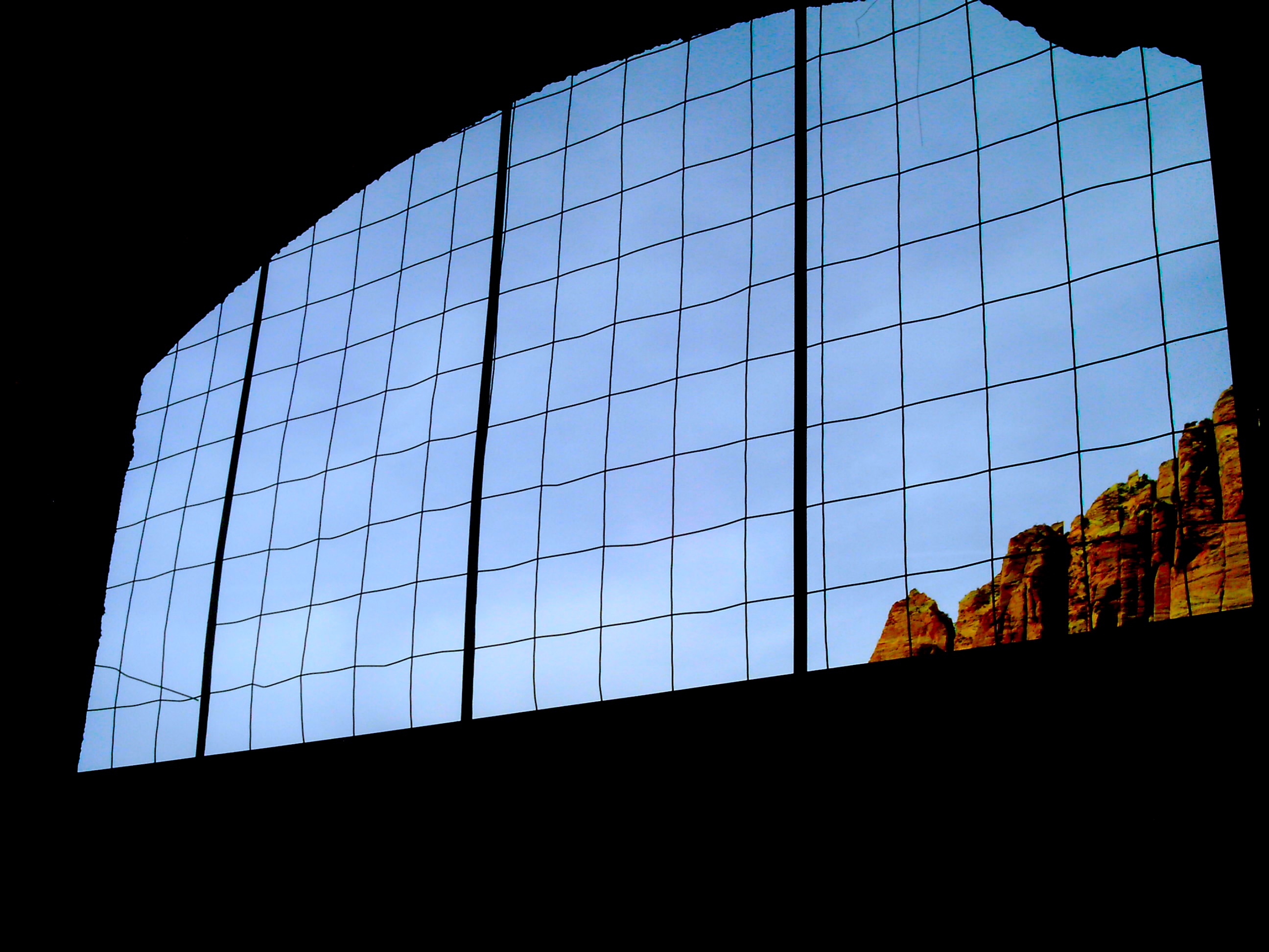
There were windows in the tunnel!
Sometimes there is an oversized vehicle that wants to go through. Apparently people in the 1920s didn’t think about the possibility of RVs. When that happens, they shut down tunnel traffic from one side and it becomes a one-way road. So if you find yourself stopped in a line for the tunnel, that’s what’s happening. It’ll get moving again in less than 5 minutes.

And a scenic overlook! Except you weren’t allowed to get out and look…or stop the car…we just slowed down and took a quick picture on the fly.
After the tunnel, there is a series of switchbacks and then you continue down the road towards the Zion Canyon Scenic Drive turnoff, then the Welcome Center, and then Springdale.
We drove past the Zion Canyon Scenic Drive the first time we came to Zion. It’s before the Visitors Center when coming from the east and there is only a small sign that says ‘Scenic Drive.’ It looks almost like a service drive. But that’s the road you want to take to see any of the amazing attractions Zion has to offer.
View at the crossroad of the Zion-Mount Carmel Highway and the Zion Canyon Scenic Drive.
A little farther back.
If you bypass the Zion Canyon Scenic Drive, you’ll find yourself at the Welcome Center. After that is Springdale. There is a ton of parking and also camping available. Zion also has a hotel inside the park but we didn’t check that out. There is also tons of hotels and restaurants in Springdale. Springdale is interesting because it cropped up in response to Zion. There is a ton of touristy souvenir shops but the restaurants are amazing. I’m vegan, and getting vegan food is difficult in Utah. But Springdale has a good selection simply because a lot of Zion visitors are of the granola subset of human beings.

The Welcome Center. Look at that backdrop.

Classic Zion.
Hotel
Even though I lived an hour away, we decided to stay in Springdale one night. I found the Bumbleberry Inn. Super close to Zion and with my mom’s AARP discount, the room was $50! It was clean, family-owned, and the view was fantastic.

Pretty nice.

Even nicer view!
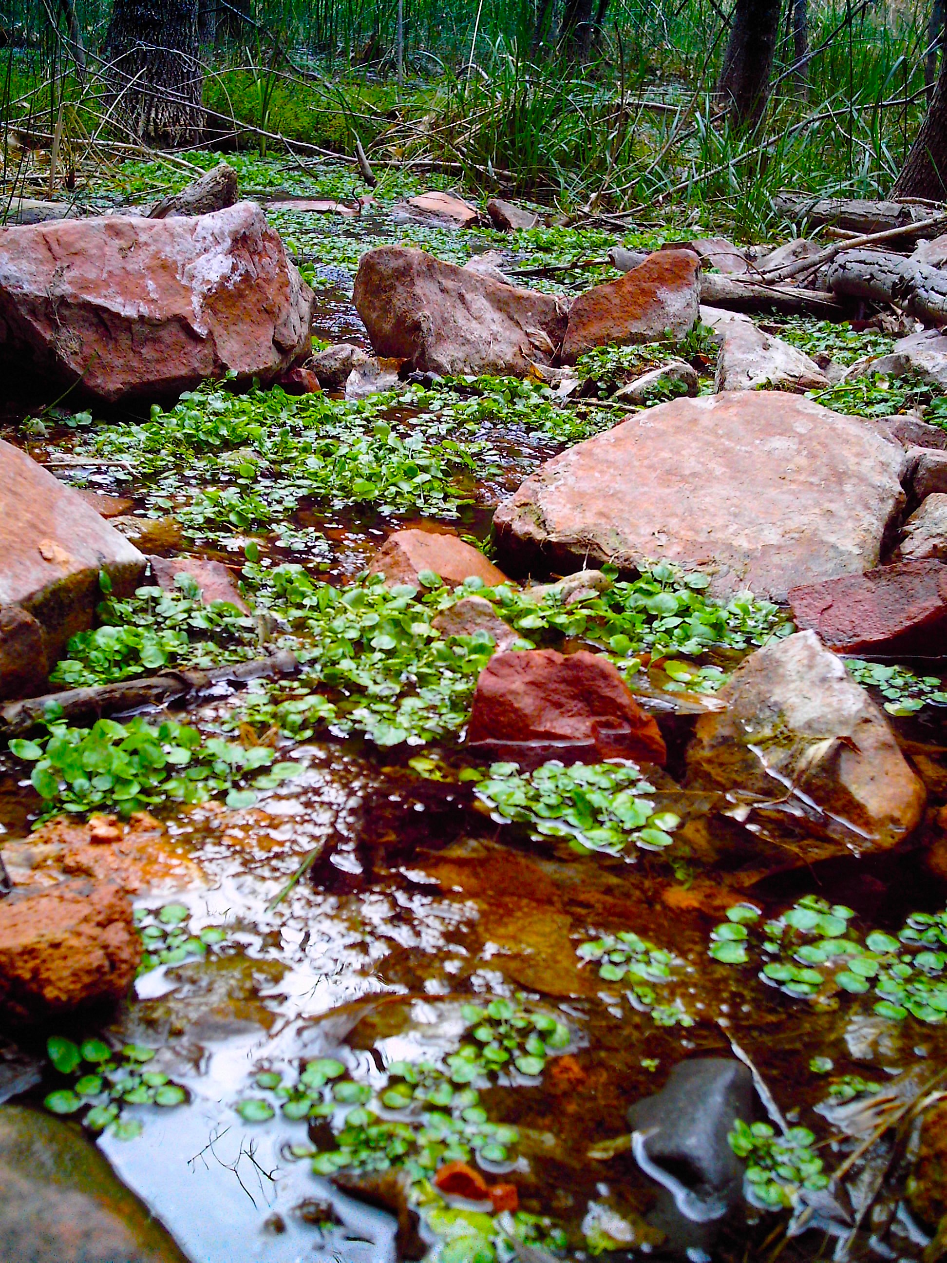
Tidepools
This is my absolute favorite hike and it’s a secret one! My neighbor in Utah told me about it and so far, nothing else compares.
After the tunnel, there are switchbacks. There is a small parking area for cars at the end of the first one. Keep going until you get to the second, slightly larger parking area to the left (if coming from the tunnel, right if coming from Springdale). Grab more water than you think you’ll use because this hike is so much fun that your water supply and the rotation of the sun are your only limiting factors. You will lose track of time.
Side note: if you look up sunset, remember that it gets darker quicker in the canyon because the sun ducks behind the canyon walls much sooner than it ducks behind the horizon.
Once ready, cross the street to the low, rocky wall. You can either walk to the end of the wall or just hop over it. You will get looks. Although you’ll get more looks when you come back over the wall, sweaty and dirty and exhausted.

The start of the “trail.”
There is a foot path worn down by many feet. It’s very rocky and unstable so some of it might best be traversed on your butt. There are little off shoots but they all head downward and I usually just stick to the biggest path.
When you get to the bottom, take a look at your surroundings or put a marker somewhere so you know when to head back up. The first time, I completely overshot the trail and I had to ask a nice couple for help. Thank goodness they were there because I have never seen more than 4 people on this trail and we’re usually heading in opposite directions.
The ‘river’ is constantly changing from water pushing rocks around but generally, when you want to head back, once you see a big swimming hole (there might even be a rope swing) created by huge rocks, you’ll know to start looking for the trail again.

The trail, worn down by past feet.
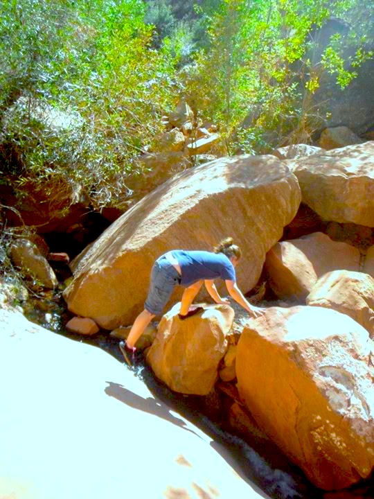
Most locals just stick to this swimming hole area. When the water’s high enough you can jump from the top of the rocks and it’s a lot of fun. But if you head either left or right, you can follow a stream broken up by boulders. I personally like the right better. The water is deeper and the rock are easier to jump across. If you go left, the rocks get huge and are really hard to climb. The water is shallow and there are less tide pools.

Big rocks divert the stream.
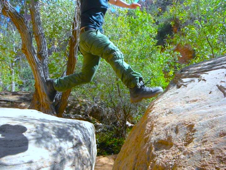
Jumping from rock to rock.
The best way to describe this place is as a playground. You’re just jumping from rock to rock and occasionally getting a little wet. You climb up waterfalls and go through cave tunnels. It’s just so much fun! I also went in the winter once. It was still cool but the water was cold so it wasn’t as enjoyable. This is a perfect hot day activity because of the water.


The rocks fell from the canyon walls into cool formations.
I know these are not official tide pools because they aren’t created by the tide, but that’s what they look like so that’s what I’m calling them. They appear every 20 feet or so, whenever the rocks are thick enough to create a pool area.
The first time I went, it was spring and they were FILLED with tadpoles. THOUSANDS, MILLIONS of them. They totally move so I wasn’t so worried about smashing them but see…I have frog fear. I don’t know why. And sure enough, the rocks were the favorite hang out place for these small, pale blue frogs. And they don’t move.
But that just shows how much I love this place. I am terrified of frogs (again, I have no idea why) and yet I willingly go to this place that is filled with them. I just have to be super careful where I put my hands and feet.

A tide pool.

When my sister and I went, it was fall and the tadpoles were gone. There were also less frogs but still enough to make me nervous. The water is super nice because it’s so shallow and sitting on rocks.
Confession time: the first time I went I just wanted to check it out for a second and I was in a skirt and flip flops. Well, as I discovered, you can’t just check this place out for a second and I ended up hiking barefoot up the stream. This is when the place was filled in tadpoles. It was spring. Spring in Utah is hot. I got hot. No one was around. I totally went skinny dipping. I was so nervous! After I cooled down, I went back, had to ask that nice couple at the swimming hole for help, and when I got to my car, I was completely dry. It’s HOT in Utah. Don’t judge.

The picture below is taken downstream to the left of the swimming hole. The rocks get really big and the stream gets really small. We didn’t go too far to the left so I’m not sure if it opens up if you keep going. Once I attempted to find the start of the stream to the right. While it was extremely cool, I could not find the beginning of the stream before I ran out of water. But the further you go upstream, the more it opens up. The tide pools disappear but the water runs down the canyon walls in some places.

So cool.
After my sister and I hiked the tide pools, we swam in the swimming hole. It was too shallow to jump into but deep enough to tread water so it was kind of cold! Again, this was in the fall. I’m sure it’s much warmer in the spring. But then there are tadpoles…so…

Swimming hole!

Below is the way into the swimming hole. The trail back to the car starts behind that tree to the left in the picture. Hopefully you don’t miss it. But if you do, you could just start hacking your way upwards until you hit the road at the top and just walk back to your car.

I have been to the tide pools every single time I’ve been to Zion. I could spend days there. It really is nature’s playground. You’ll feel like a kid again. It’s the only trail I’ve discovered where the journey truly matters more than the destination.
Emerald Pools
My mom and I did the Emerald Pools hike. We were rushing because it was getting dark and hiking in the dark is stupid but we wanted to do it so we did it fast. The Emerald Pools themselves weren’t that cool. They were tiny and shallow and more like puddles than pools. They were green, though, so that’s something, I guess.
The hike itself was actually pretty cool though. It was narrow and there were makeshift steps and some tricky footing. It felt like trekking through uncharted territory because it wasn’t cleared away. You had to climb over fallen trees and such. So the pools themselves suck, but the hike to them is pretty cool.

So…this was it.
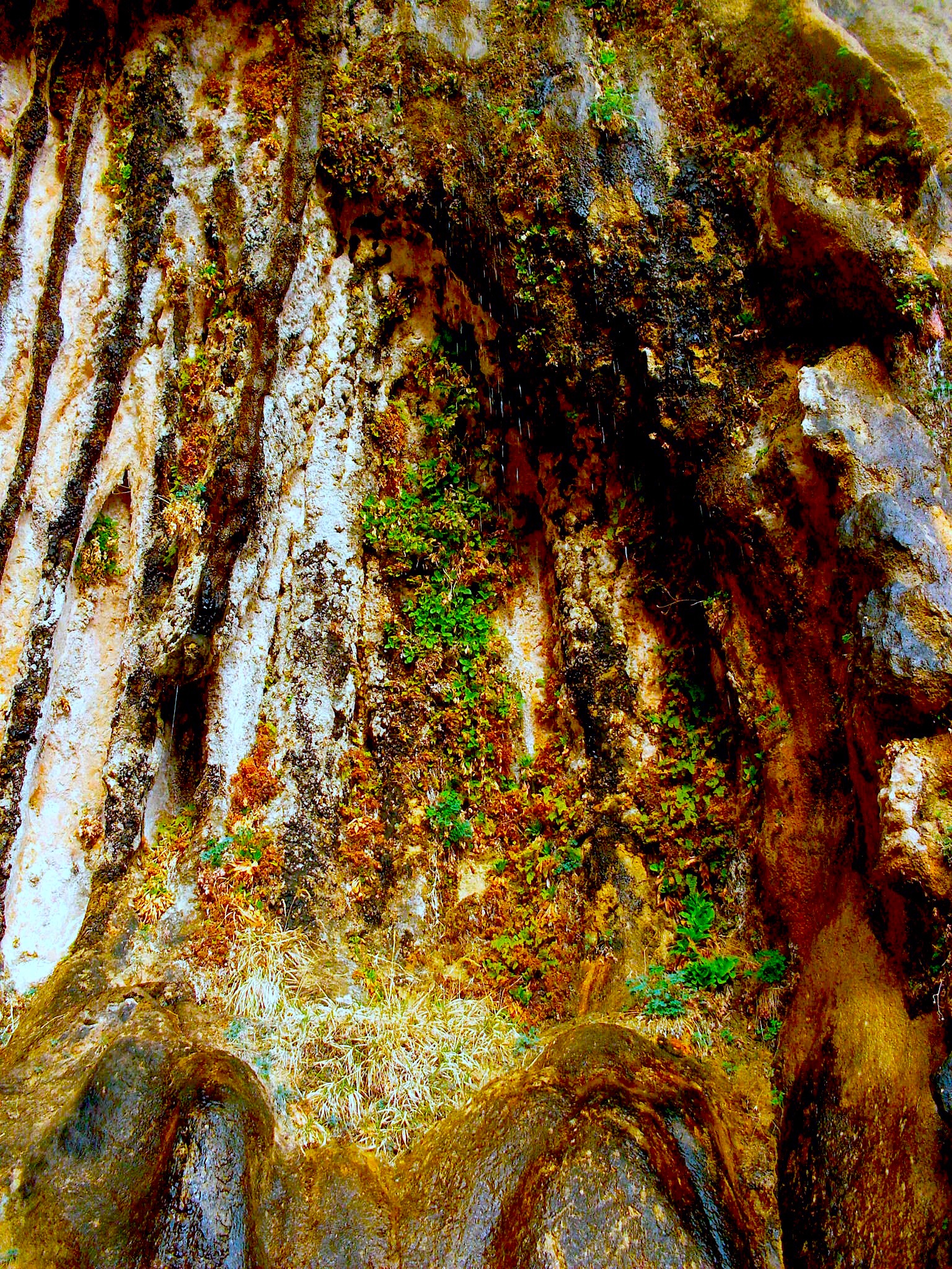
Weeping Rock
Weeping Rock is one of the first attractions you get to on the Zion Canyon Scenic Drive.
I like Weeping Rock. It’s just plain pretty. It’s basically an overhang that water drips over. But it’s so pretty! The rock colors, the water dripping down the walls, the moss and plant life, the view.
Weeping Rock is small and sometimes can be pretty crowded and is very touristy, but I think it’s worth it. I’ve seen “weeping rocks” before but this one definitely earns the right to be called Weeping Rock proper.

Weeping Rock overhanging the walkway.
The water coming over the top.

The view. Can you see the “raindrops?”
The moss on the walls.

The water trickling down.
The beautiful rock colors.
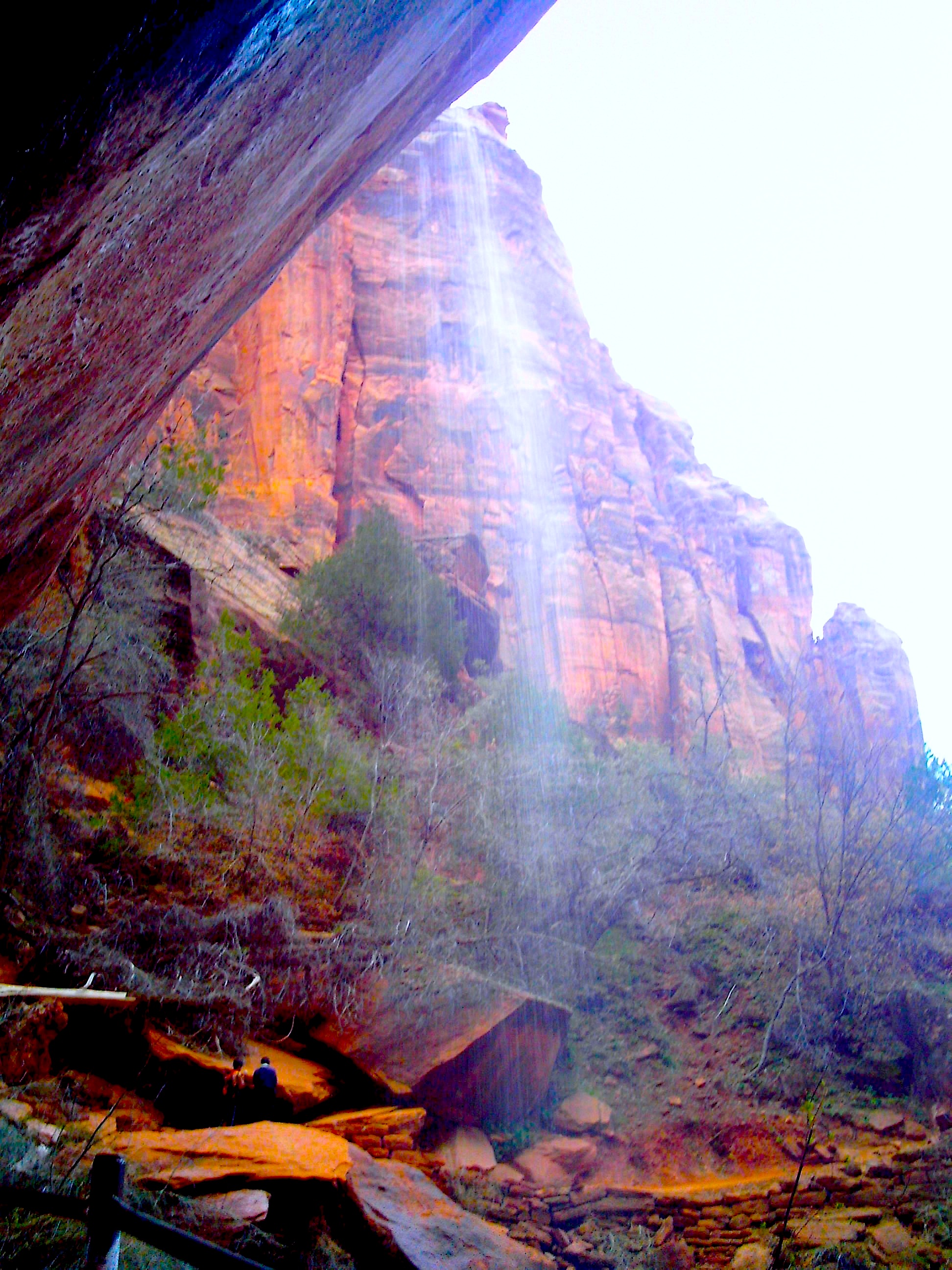
Temple of Sinawava Falls and The Narrows
The last attraction on the Zion Canyon Scenic Drive is the Temple of Sinawava. I’ve been there twice and I’m still not sure what it is. Is it this waterfall? It’s a really high waterfall but there’s not a lot of water and you’re separated from it by a river.

The walk to the falls.
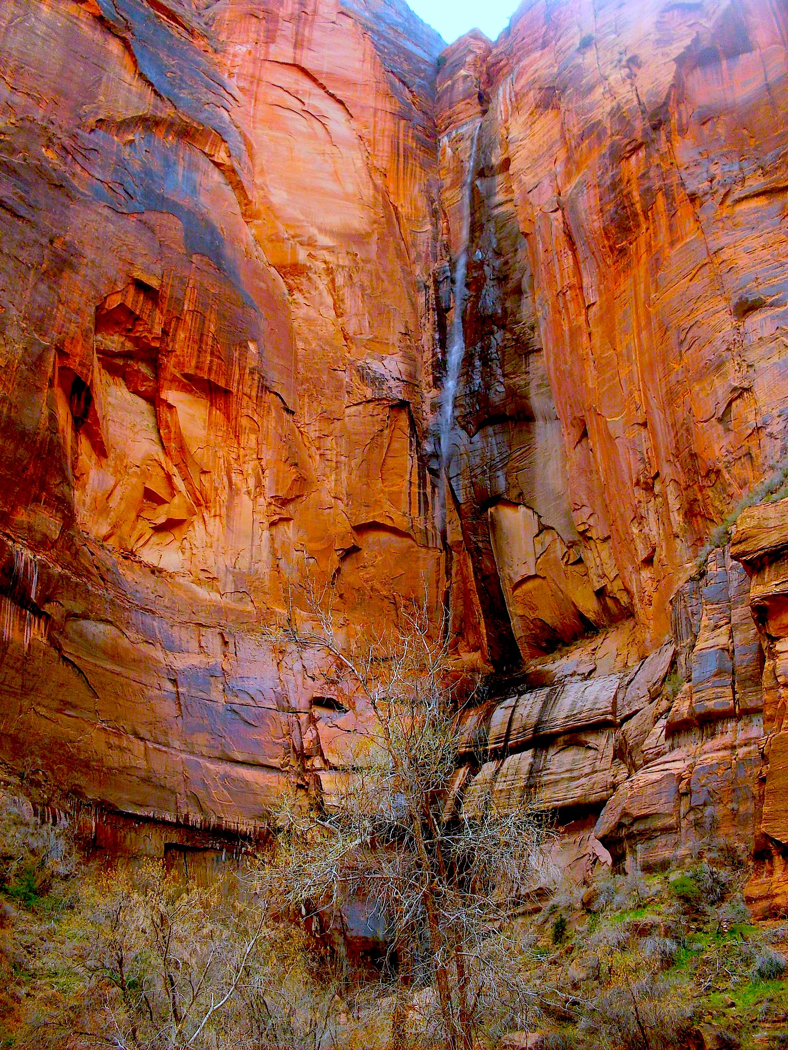
The falls. Veeeerrrryyyy tall, not much water, though…
After we looked at the waterfall a bit, we found another path that went further into the canyon. It had quite a few people on it so we followed it. For quite a while. Was the Temple of Sinawava at the end of this trail? The trail was deceptively long but we stuck on it and found…the Narrows?
Apparently this is the start of the Narrows! It wasn’t on the map we got at the gate but here it was! Apparently that waterfall WAS the Temple of Sinawava or something.
Anyway, there were a lot of people heading into the Narrows, all drysuited up and carrying walking sticks. The water was a little too cold for us to go venturing and we hadn’t planned on hiking the Narrows so we didn’t have the right gear. The bottom of the river is very rocky so you at least need good shoes. And when it’s cold like that, you can’t go in in just your clothes or you’ll get hypothermia. But there are plenty of places to rent drysuits and any gear you would need in Springdale. We saw a lot of people going in wearing matching drysuits and booties.

But there’s a trail that leads to…the Narrows!

The water was cold when we went so we didn’t go in.
The beach area was still cool though because people had filled the area with rock sculptures.

People made rock sculptures all over the beach.
Every time I encountered a swamp area, I was all, “What? This is a desert, man.”
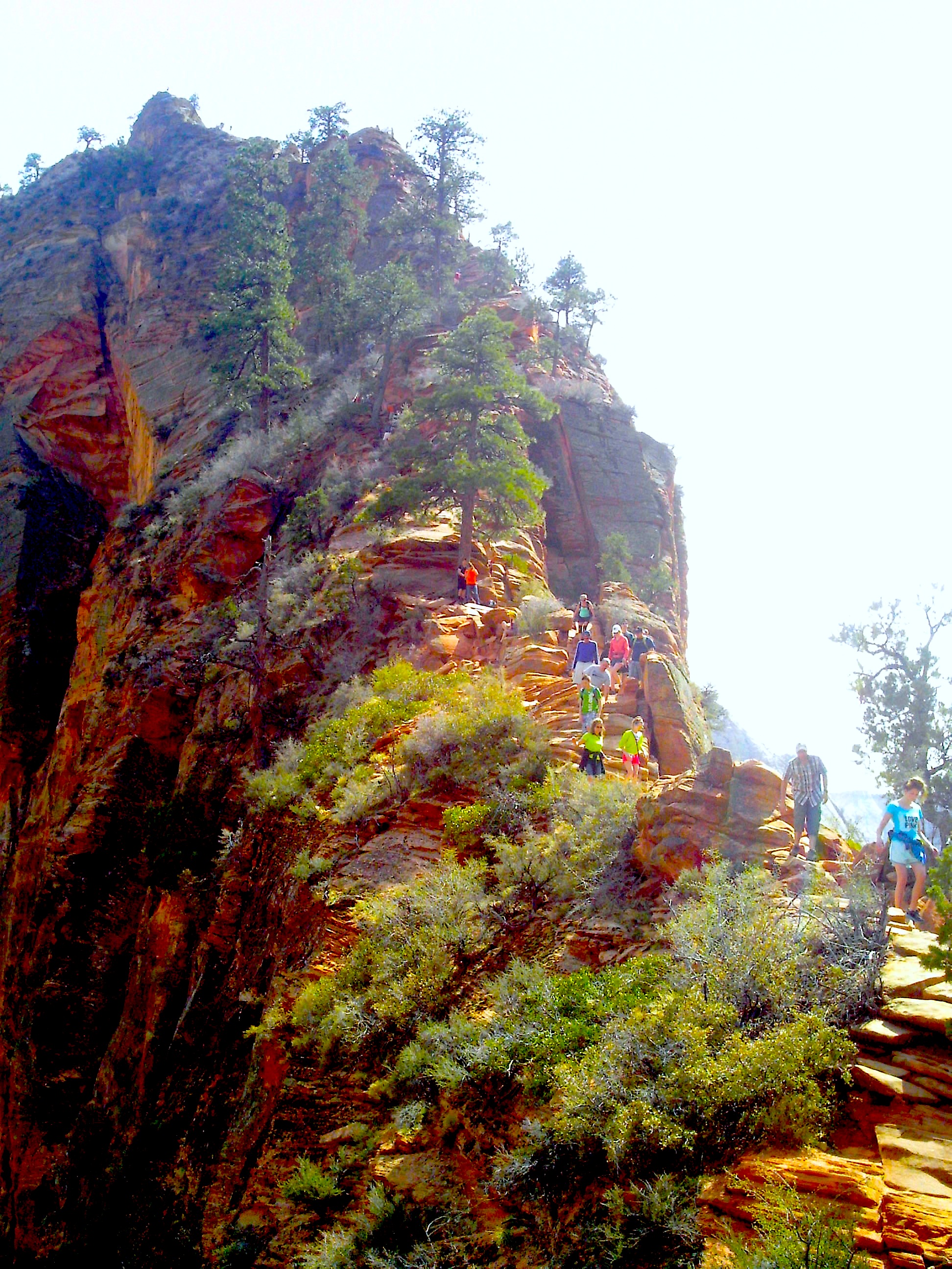
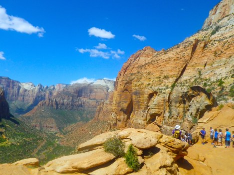
Angel’s Landing
Ah Angel’s Landing. Infamous for being dangerous and difficult, my mom and I were supposed to hike it when she last visited but I had a head cold so we didn’t go. Thank God. There is no way you can hike this with a head cold.
After a harsh winter, once it warmed up, I decided to start my hiking season with Angel’s Landing. I was a little out of shape but still managed to do it. Angel’s Landing isn’t so much difficult as just constant. You are constantly hiking up a gentle (and sometimes not-so-gentle) slope.
First, you hike up these switchbacks. I thought these were the famous Walter’s Wiggles but they were not. They were just switchbacks. After the switchbacks, you go through Refrigerator Canyon. Man is that nice on a hot day. THEN you have Walter’s Wiggles. Those are steep. I had to catch my breath a few times.

Walter’s Wiggles.
After Walter’s Wiggles you’re at the top! Except not really. After Walter’s Wiggles, there is a flat area where a lot of people hang out. I saw people eating picnics, reading books, playing video games on their phones. There was even a port-a-john. How they got it up there, I have no idea.

Not sure how trees grow all the way up there with no dirt.
After the flat area, it narrows and slopes upward. At the top of THAT is Angel’s Landing. Let me tell you something. It took me a good 2 hours to hike to that point. All uphill. I was TIRED. I was drained. I didn’t want to keep going. But there was no way I wasn’t going to go to the top after making it this far.
People on the way to the very top.
This is where the chains come into play. When I first read about Angel’s Landing and the chains, I thought they were there in case people wanted them. Um, no. There are some parts where you literally need to pull yourselves up by these chains.
And it’s two-way traffic. People going up and down are both trying to use the same trail and the same chains. There is this give and take system that develops where large groups of people take turns. But sometimes you are holding onto the chain while people literally climb over you.
To help you understand how focused you have to be while climbing, after I got down and was waiting for the shuttle, I saw two of my friends from work. One of them passed me going down while I was going up. I never noticed him and he didn’t say anything to me because he said I looked super focused and didn’t want to break my concentration!
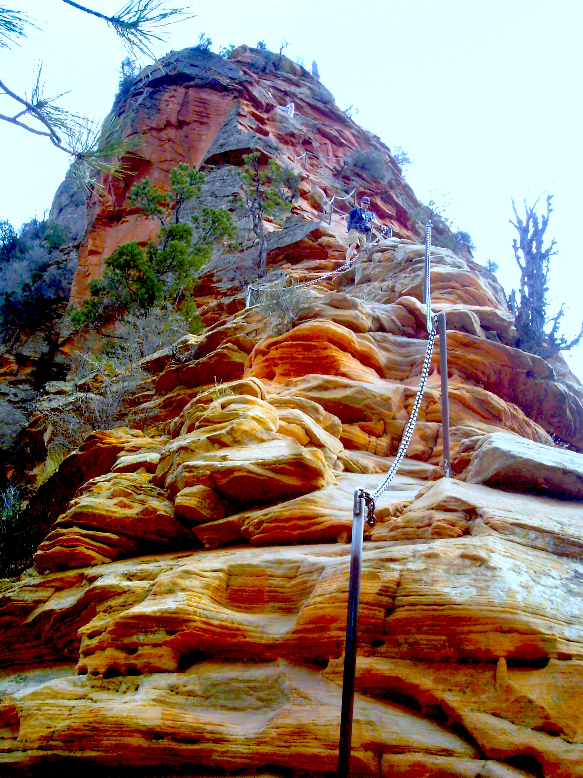
The chain to the top.
When I finally made it to the top, I was a little light-headed. I found a spot and sat down immediately. I ate some food and drank some water and just sat, letting my body get acclimated. I was actually afraid to walk around up there for a while. There is no fence and it isn’t flat but kind of slopes downwards on all sides towards the sheer drop off. It’s also not that big and I felt a little claustrophobic with all the people around. One guy on a rampage could probably take a quite a few people with him if he wanted.
It was so dangerous! No fences or anything.
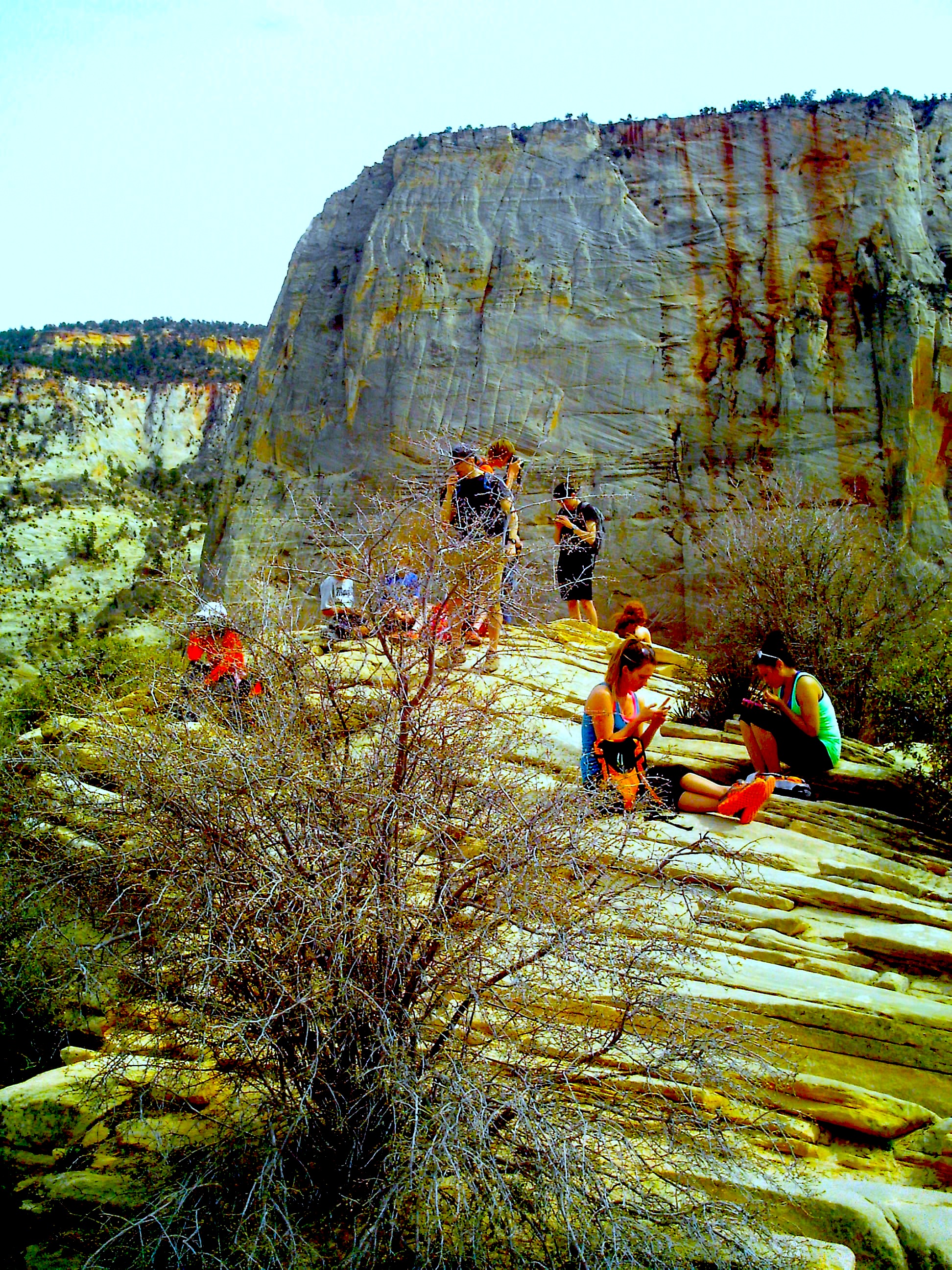
Apparently their phones are cooler than the view.
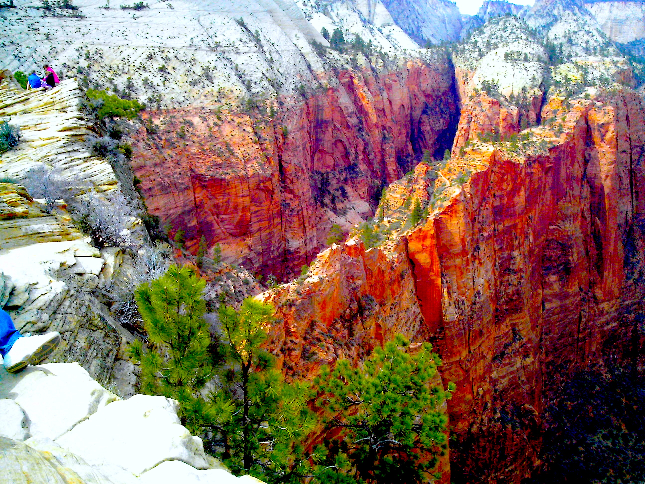
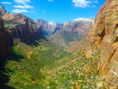
But man the view. From up here you could see the geography and geology of the place.
The view. Better than a phone in my opinion.
Not sure if that’s a road or river? I was so high up.
I was in for a rude awakening if I thought going up was hard. Going down was somehow worse because the angle was just steep enough to pound on your knees with each step. I met so many people who had to stop on the way down to rest their knees.
The people on Angel’s Landing were an interesting bunch. The St. George fire department was running the trail, carrying a 50 pound weight between them. An extremely old man passed me like the wind. A little girl was dancing around her tired family. A moody teenager was just not having it. And on the way down, a lot of tired people asked me if it was worth it. I told them it was even though I didn’t believe it. The view isn’t worth it. But knowing you did that crazy ass hike is.
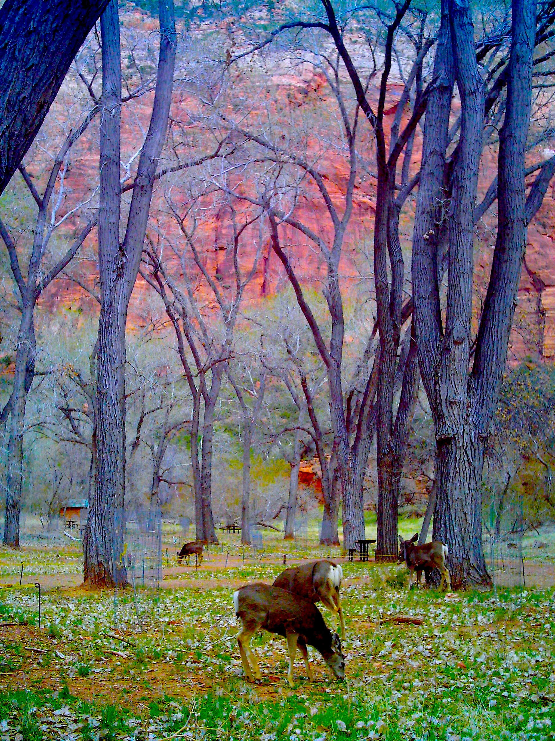
Deer at The Grotto
When the sun starts to go down, the deer come out. And they know they’re in a national park because they have zero fear. The Grotto is another attraction on the Zion Canyon Scenic Drive but I’m still not sure what it is. We just stopped because we saw all these deer.
We got so close to them! And they were freaking adorable.
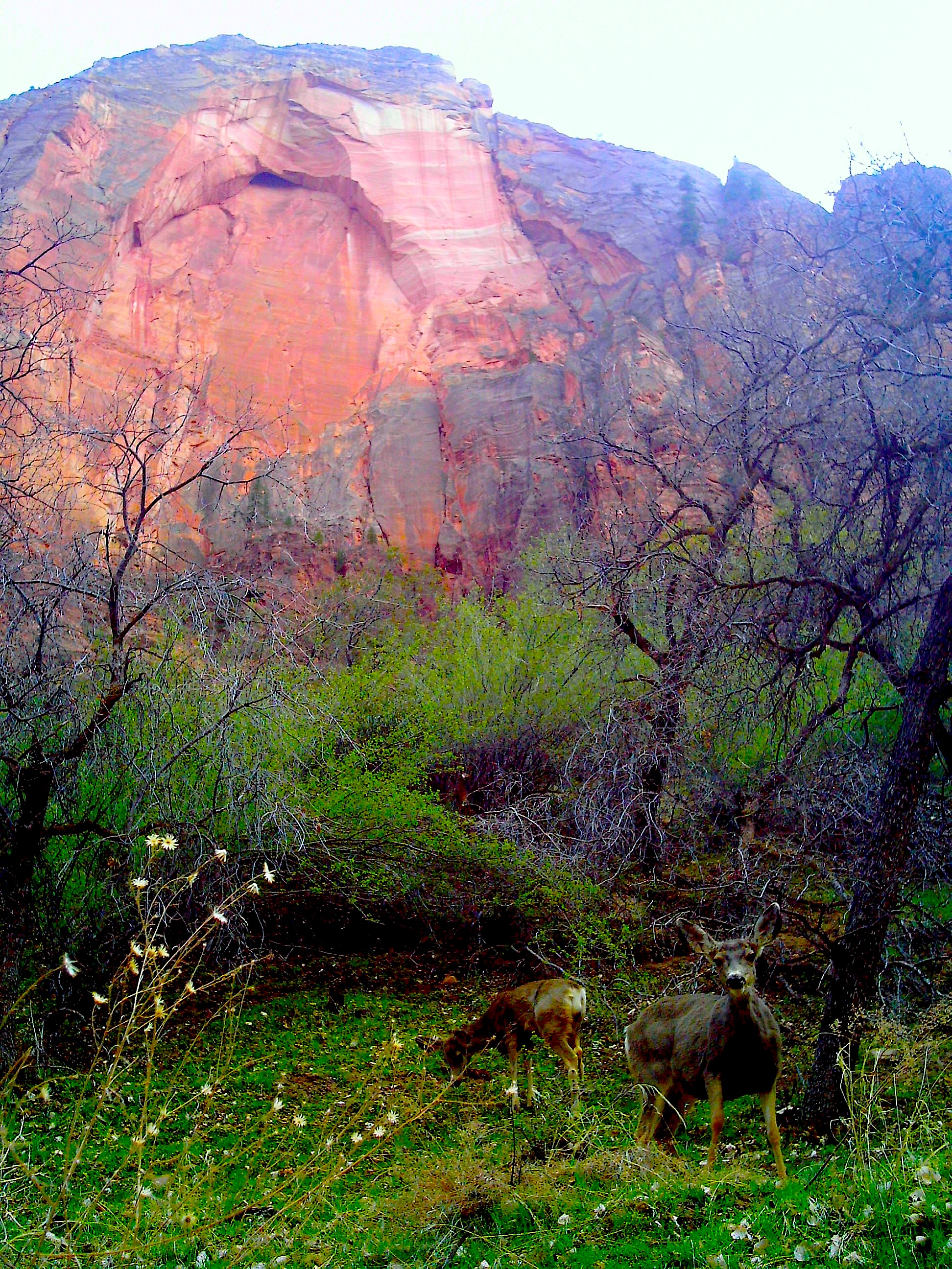
The deer had no idea they were in one of the most gorgeous places on earth.
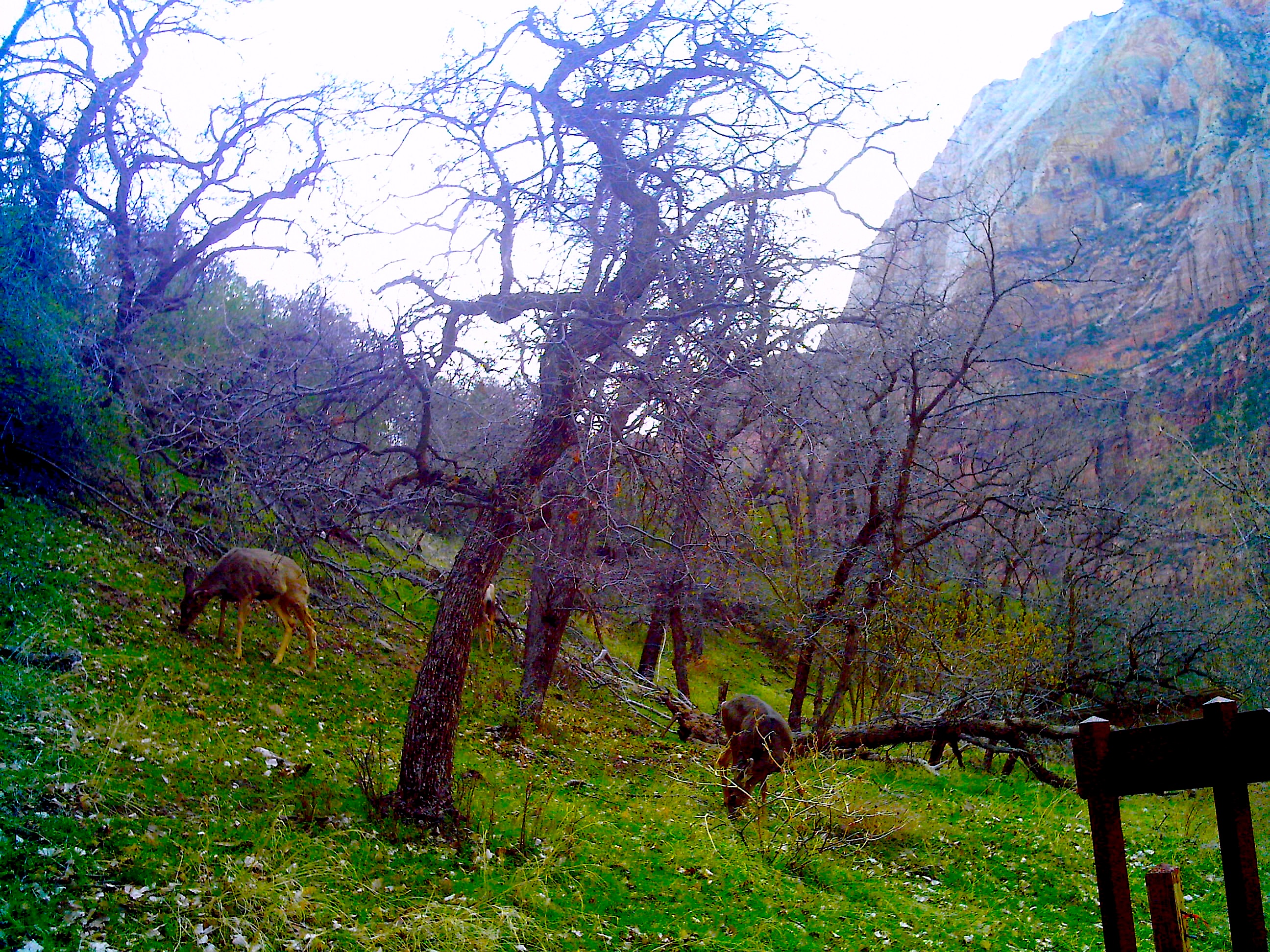
Just eatin’ and hangin’.
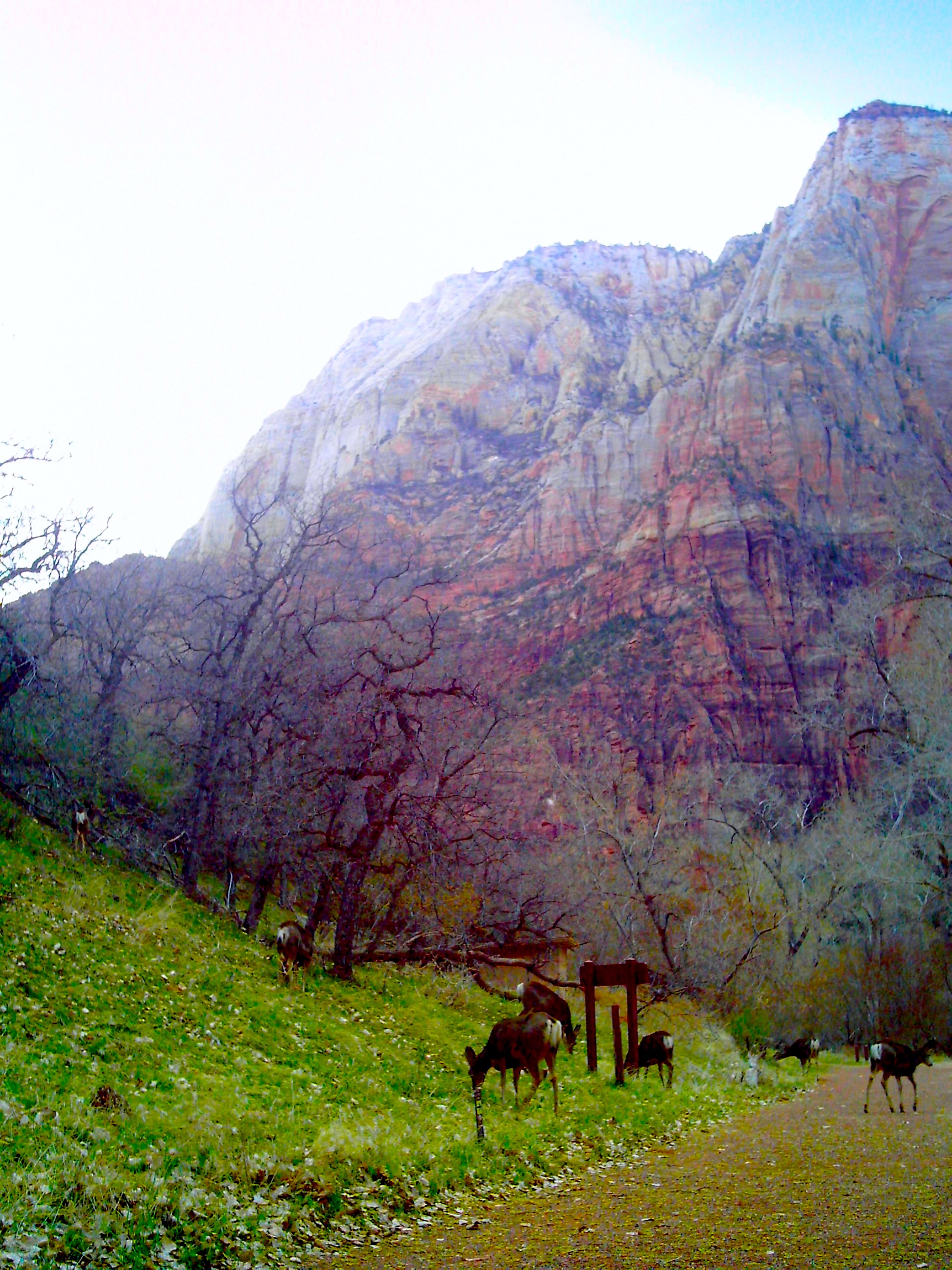
Soooo many deer.
Side note: the deer in Utah are no joke. When the sun goes down, please slow down. We drove the hour into Kanab from Zion after the sun went down. Without exaggeration, we must have seen 200 deer on the side of the road.
They were so out in the open.

This little guy was so cute!
The Overlook
I had been avoiding The Overlook trail because it was always the number one recommended hike and it even has a parking lot. It’s only 1 mile. I assumed it would be kind of lame. Boy was I wrong.
The Overlook was actually kind of hard-core! It had narrow trails, a rickety bridge, no fences, and steep stairs.
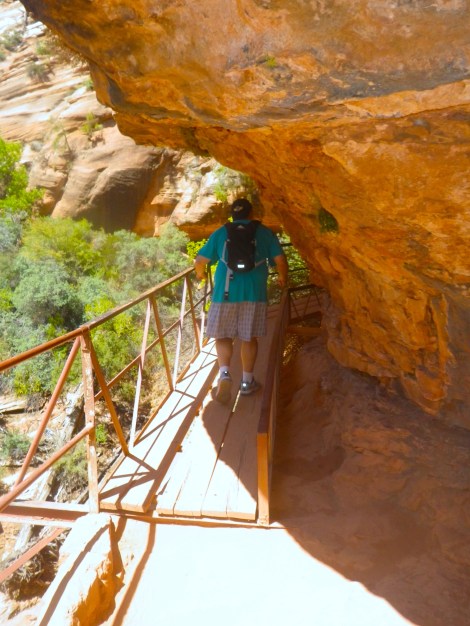
An honest-to-God rickety bridge.
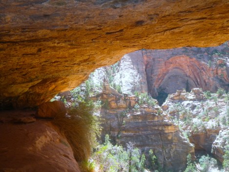
A cave with overhang.

Some of the trail was super narrow.
There weren’t any signs or rock formations to follow. Basically, just keep veering towards the right whenever you’re not sure where to go.
At the end of the trail, you kind of just wander around until you reach the edge. There is literally just a ten foot long fence. The rest of the long edge is unfenced. It’s hilarious. You can just walk a few feet away and walk off the edge if you wanted. Totally freaky. I got five feet away, laid down, and army crawled to the edge. Seriously, you could you die. God, I love Utah.
The actual overlook at The Overlook. See the tiny fence?
The view at the end.
Last Thoughts
Like I said before, Zion National Park is worth traveling across the country for. There are both structured activities and also chances to explore on your own. Zion National Park is hands down the best national park I have been to, for both its natural beauty but also for how the park is set up. God and government have never been so perfectly paired.

Pingback: Northern Nevada | Louise and Claire·
I want to go back…soooooo bad!!!
LikeLike