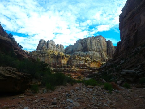
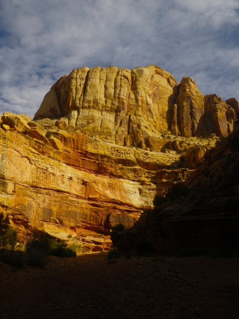
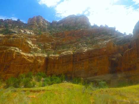
Standing on the Gooseneck Overlook, Capitol Reef National Park surrounds me on all sides, including below and above. Sunlight dances over the whites, greys, reds, pinks, browns, and even greens of the canyon walls.
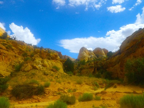
Most national parks in Utah feature specific rock formations, whether it be the hoodoos of Bryce Canyon or the deep fissure of the Grand Canyon. Capitol Reef is a hodge-podge of different rock types. The colors and structures vary greatly from one plateau to the next. There are looming plateaus and deep canyons. Crumbled rock and those ornately shaped.
Staying
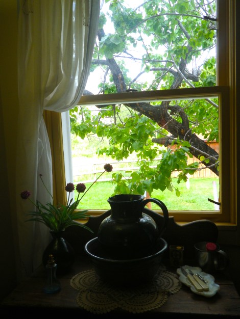
We stayed at the Fruita campground. It was walk-in only and we were lucky enough to find a spot despite it being a Sunday night. The tent sites are not well-defined; the entire campground seemed to be designed with fitting as many people in as possible.
There is a nice bathroom facility but no showers. Water is available. Capitol Reef is a designated dark sky park but it was too cloudy to see anything the night we were there. In the morning, deer ate their breakfasts right alongside the campers.

History
There is an 18 minute video at the visitor’s center that talks about the history of Capitol Reef, which was surprisingly interesting. I don’t usually write about the history of national parks but this one had a strong human element that adds to experience.
Fremont Indians lived there from 700AD to 1300. Mormons came in the 1800s and set up a small town of no more than ten families, but as my sister pointed out, that was probably a few hundred people because of how large Mormon families are. The Mormons planted orchards that still exist to this day. It was a closed community with its own school house and blacksmith shop. WWII brought an end to their community, called Fruita.


Scenic Drive
There is an eight (or possibly ten depending on what sign you choose to believe) mile scenic drive that starts near the visitor’s center. It takes between 1-3 hours depending on how often you get out of your car and if you do any of the washes or hikes along the way. It took us three hours.
Capitol Reef National Park has those sweeping vistas you hear about. You can literally see for miles; the canyon walls do not loom over you unless you hike into them.


Grand Wash
There is a dirt road off the scenic drive that, frankly, looks unfriendly. There are signs warning of flash floods. We went anyway. There were several turnoffs for photo opportunities and we ended up hiking a little way towards a dry river bed.
At the end of Grand Wash is a parking lot complete with a vault toilet. Two hikes started there: Cassidy Arch and The Narrows. We decided to do Cassidy Arch because it said it was only 0.3 miles. Then a different sign said it was 0.4 miles. We started hiking and found the turnoff that said Cassidy Arch was another 1.5 miles away. I’m telling you, someone needs to regulate these signs.
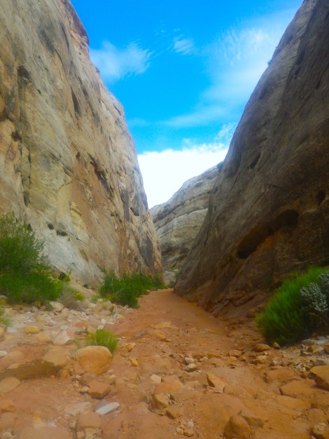
We decided to hike to The Narrows instead. It was a long hike. But I have no idea how long because there was no signage. Sigh.
The Narrows loomed overhead. It wasn’t a slot canyon, though. If you like hiking and want to see some beautiful landscapes, hike to The Narrows. If hiking isn’t really your thing or you are expecting a classic slot canyon, I wouldn’t recommend it.


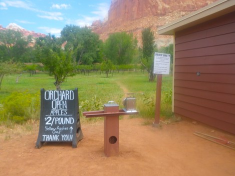
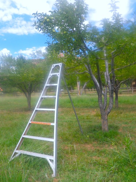
Orchard
Near the visitor’s center is an orchard where you can pick your own fruit. Pies and other souvenirs are available at the Gifford House, a reconstructed historic home.
There are old-timey (or possibly futuristic?) ladders and some good old-fashioned apple grabbers available for use for free. Payment was on the honor system: one pound of fruit for $2.
Yellow apples were the only fruit available when we went. I thought they were unripe, they were so small. But then I realized, this is what an apple is supposed to look like. Small and full of worm holes and delicious.

Capitol Gorge – The Tanks
At the end of the scenic drive is another wash that leads to either the Fremont River or Capitol Gorge. Fremont River requires a high clearance vehicle so we went to Capitol Gorge. It leads to a parking lot with a vault toilet. Two hikes originate there: Golden Throne and the Tanks.
Golden Throne takes you to the base of the Golden Throne and is two miles one way. We went to the Tanks a mile away. The first 0.8 miles is in a river bed and an easy walk. Not long into the trail is a sign pointing to petroglyphs left by the Fremont Indians. The video at the visitor’s center made it seem like the petroglyphs were hand-sized. They were some that were easily two feet tall. It was eerie, seeing a man with antlers staring down at you.
We kept going until we reached a sign indicating that the Tanks were up. So we went up. And up.


There were some 3 foot tall petroglyphs that were pretty cool.


TIP: follow the piles of rocks placed by hikers. We would have gotten lost several times over if there were no rock piles. If you’ve read my previous posts on Utah, you will know there is a serious lack of signs in that state.
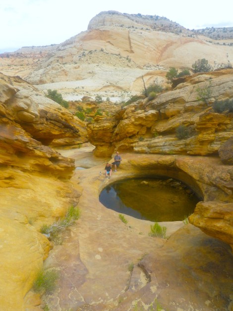
The sign at the base said it was 0.2 miles to the Tanks (the sign at the trailhead said it would be 0.3 miles once we reached the sign). It felt much, much longer, but we were hiking up at a 45 degree angle in most places. We were sure we had taken a wrong turn or passed the tanks or something but then there it was: the Tanks. Or more accurately: one tank.
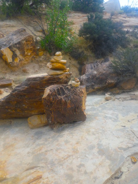
Honestly, it was a bit of a let down. I had expected tens or hundreds of tanks in the rock, but instead it was one large one and two tiny ones, only one of which was filled with water. There was a picture of the tank at the trailhead and I had assumed that was one of many. Nope. That was a picture of the tank. That was it.
Storm clouds rolled in and we hoofed it back to the trailhead and drove back the way we came because the scenic drive is one way.

Last Thoughts
You could spend weeks at Capitol Reef. There is a 60 mile scenic drive we didn’t dare attempt and plenty of backpacking opportunities. It is simply immense. But I feel the scenic drive does a good job showing you all the different rock formations and colors Capitol Reef has to offer. Rock lovers and geologist nuts would be in heaven.
Capitol Reef is so immense that it feels a little impersonal at times. There were moments where my sister asked if she should stop so we could take pictures but we declined because we had already taken so many. It’s almost like the beauty was overwhelming and the only way to deal with it was to shut down. I’ve said it in other blog posts before, but Utah makes you spoiled. Capitol Reef is no different.

One word. Powell.
LikeLike