My mom wants to visit all the national parks in the United States. There are a ton in Utah and Alaska and, I thought, none near Michigan where we live. Turns out, there’s one in Ohio!
It only became a national park a few years ago, but northern Ohio is home of Cuyahoga Valley National Park. My mom grew up in northern Ohio and remembers the Cuyahoga River actually catching fire a few times, it was so polluted.
I did some research and found out that boating on the river is not recommended because it doesn’t meet recreation standards. Basically, the river is still polluted. This might be why it was made into a national park; to get it under control.
We only had a weekend, so I scoured the Internet for suggestions of the best things to do and came up with a couple.
Ledges Trail
People seemed all about the Ledges Trail so we went for it. We arrived at the Cuyahoga Valley National Park, stopped at one of the many visitors centers for a map, and found our way to the trail. There wasn’t one main road that all the “attractions” were off of so we had to use our map reading skills and GPS to find the Ledges Trail.
The parking lot is in the middle of this circular trail, so I guess we could have started anywhere, but there was a paved road near a big sign so we took that.
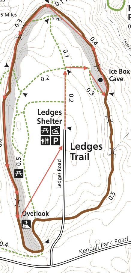
The path we took.
It was cold and getting a little dark by the time we made it to Cuyahoga Valley and we still had to find the campground, so we planned on doing the trail very quickly and getting out of there. Big mistake. I wish we could have stayed longer, this place was so cool.
Once we hit the actual trail, we went left towards Ice Box Cave because why not, and found ourselves in a little forest. Soon we came upon a crack in the ground. Oh man, I wanted to jump to the other side. There was what looked like an easy way into the crack from the other side and I wanted to go down there so badly. That’s when I heard some voices of other hikers down below and found the trail a little ways away from the crack, but at the bottom. The trail was going to go down there!

Top of the trail. We’ll be going down in there in a minute.
We followed the trail and came upon Ice Box Cave but it was fenced off. I was bummed we couldn’t go into the cave but glad it was fenced off because the bats inside had apparently gotten hit with a fungus brought in by all the hikers from around the world. They fenced it off to give the bats time to heal from it. Years ago, my mom and dad were in northern Michigan taking a cave tour and my mom remembers the crew asking everyone what caves they had been to make sure they didn’t bring in the fungus. Crazy.
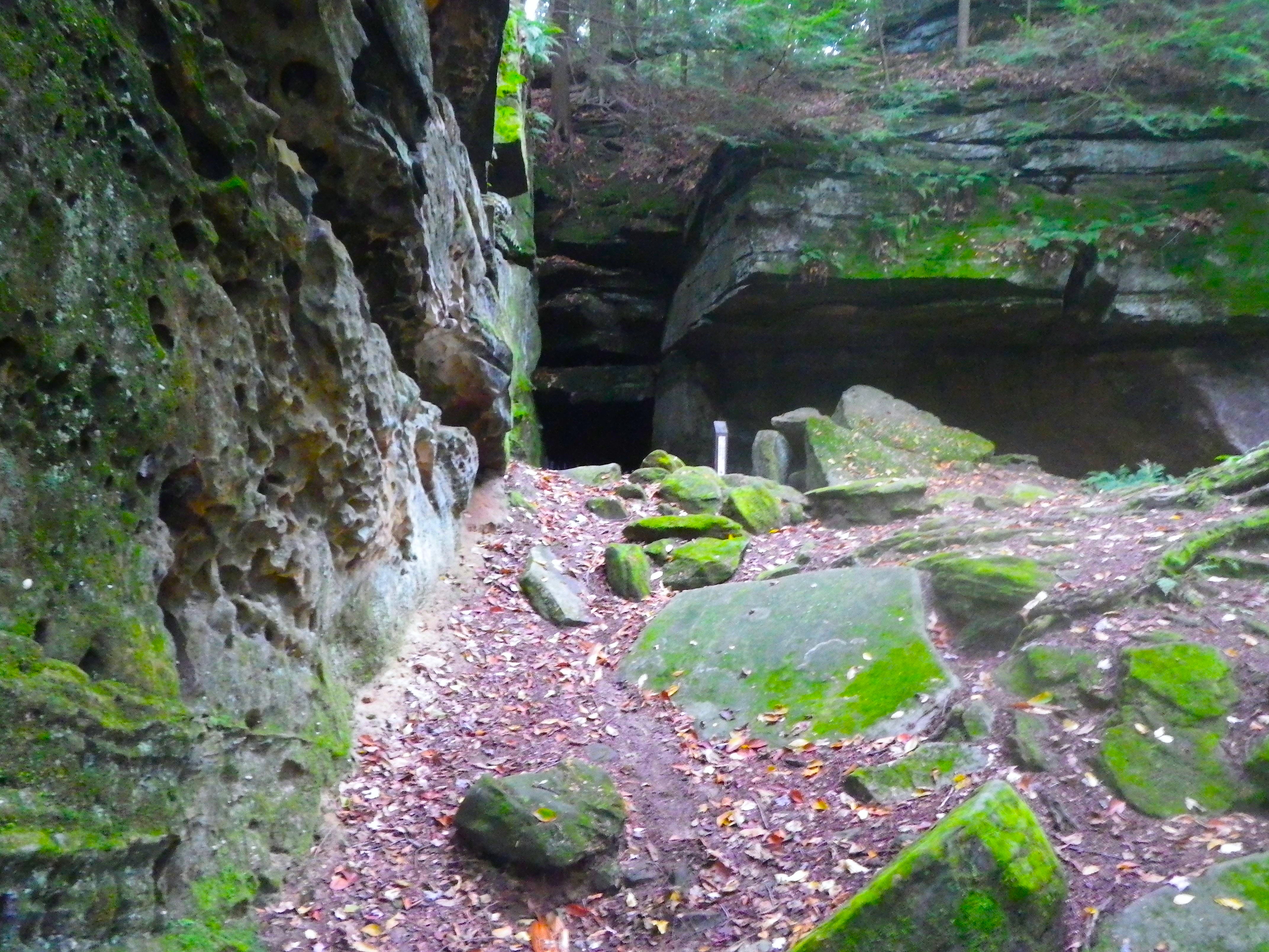
The bat cave. It was roped off because they have an outbreak of a fungus that causes White Nose Syndrome.
Side note: after looking at the pictures, we saw a ton of white spots. I’ve seen my fair share of ghost hunter shows and knew what this meant. If you’re a ghost hunter, I recommend the Ledges Trail. I’m not sure the entire history of the Ledges Trail but we did come across some old steps built hundreds of years ago. Anytime people are building anything hundreds of years ago, you have deaths. And apparently, ghosts. Someone get on this.
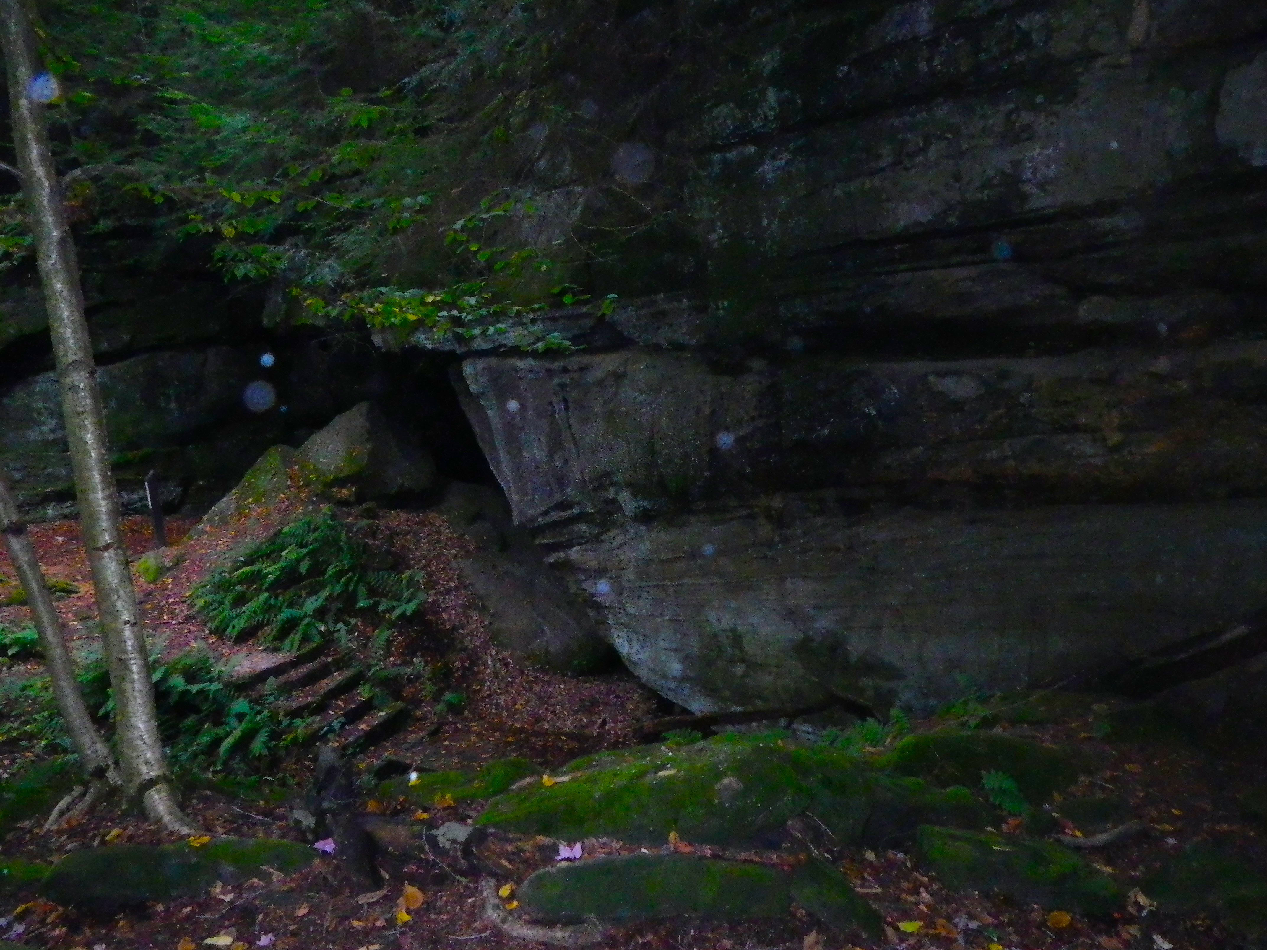
Ghosts?
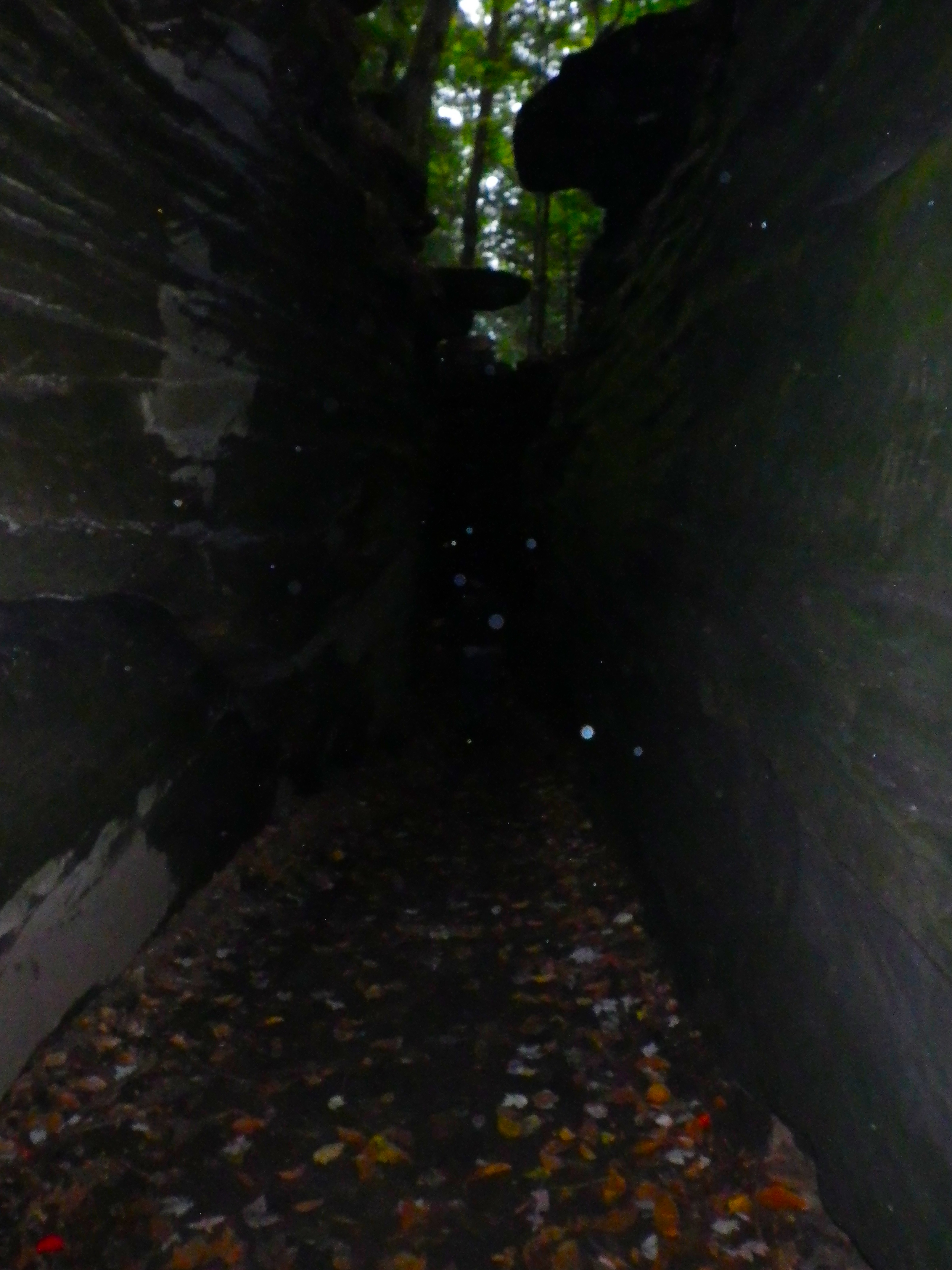
Definitely ghosts.
After the Ice Box Cave, we came to the crack! Now, we saw signs everywhere saying No Rock Climbing. It was only much later when I wondered if they meant No Climbing Rocks. Two very different things in my opinion. Because we climbed rocks. Oh boy, did we climb rocks.
The entrance to the crack wasn’t obvious. It was set back off the trail and hidden by a small clump of huge rocks that had fallen from above. I only noticed the entrance to the crack because the clump of rocks had made a freestanding “cave” and I climbed my way through it. If we had kept on the trail, it would have taken us right past the freestanding “cave” and we would have never seen the crack.
Once through the “cave,” I could see a skinny crack in the cliff wall and made my way towards it. It was about shoulder width wide and looked like it dead-ended until I got closer to the end and realized it made a 90 degree turn into the larger crack we saw from above.
I went back and watched people from my crack entrance. I could see out but they couldn’t see in because it was so dark in that tiny space. Some hikers came from the other way but never got off the trail. They walked right past the fallen rock “cave” and, therefore, the crack entrance. My mom came through the rock “cave” but looked down the trail to the right as she jumped down, not seeing me or the entrance. I heard my mom ask my dad where I was. They were about to continue on the trail to find me when I called out.
They followed my voice and climbed through the entrance. The Ledges Trail is great and all, but this was the cool part even though it wasn’t technically on the trail.

In the slot canyon thing.
It was like the slot canyons of Utah except full of moss and leaves. I thought geology happened in the southwest of the country – that had been my experience, anyway. But apparently it happened in Ohio, too. Now, I’m not sure how this thing was formed but I’m sure the Internet has answers. In Utah, everything is sandy and you can contribute to the evolution of the canyons by running your hand along the walls. But this thing in Ohio was HARD. It makes sense when it’s sandy. This was just confusing.

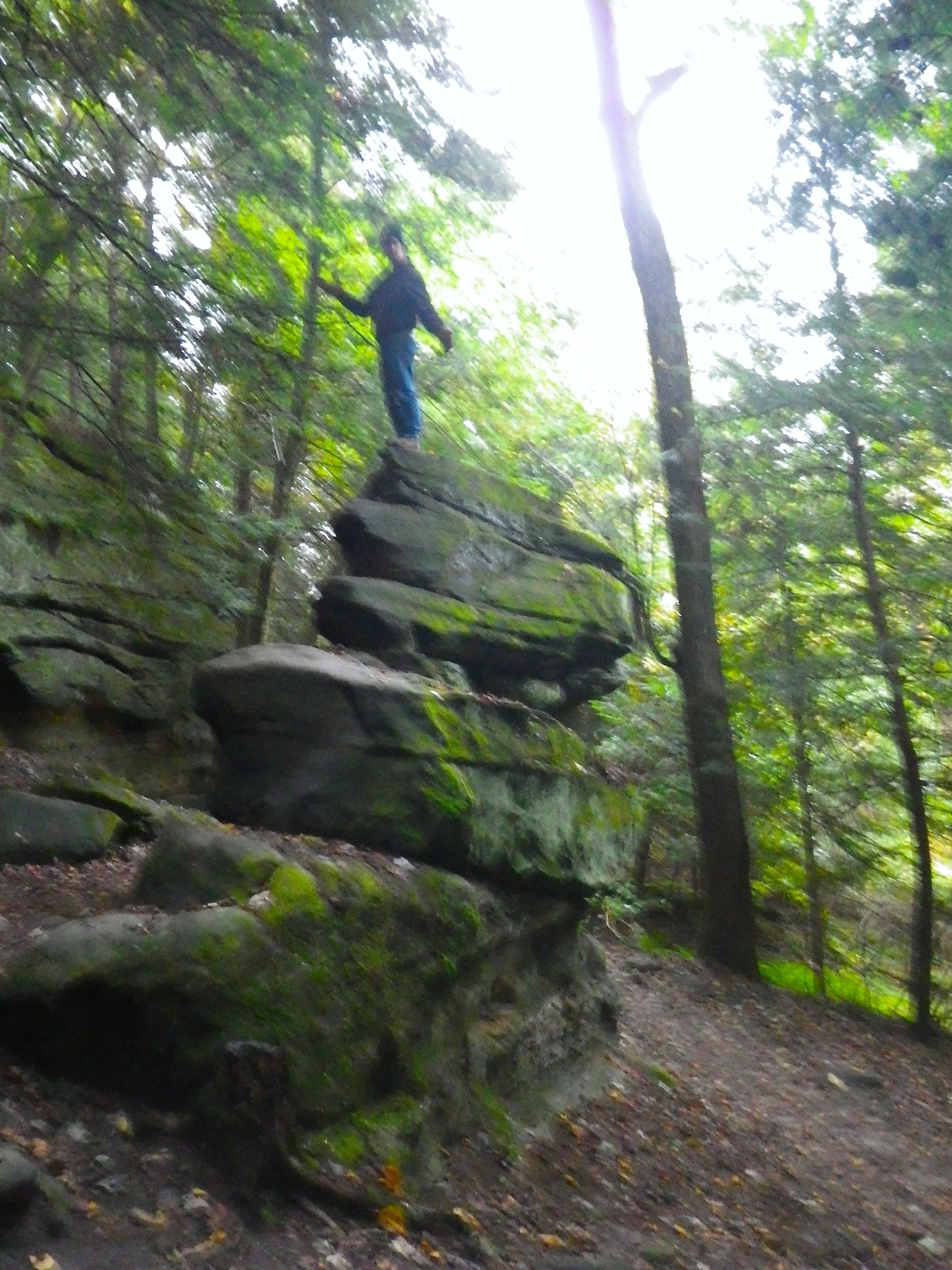
Looking up at the top of the trail.
Another cool bit was that someone was creating artwork on the walls. This wasn’t some rich kid carving his name into a national landmark. This was something people will look at centuries from now. I guess I’m just assuming it’s current because of how detailed it is and what the heads look like, but really I have no idea when it was made. It reminded me of the Ancient Roman section of museums.

Someone carved stuff into the walls!
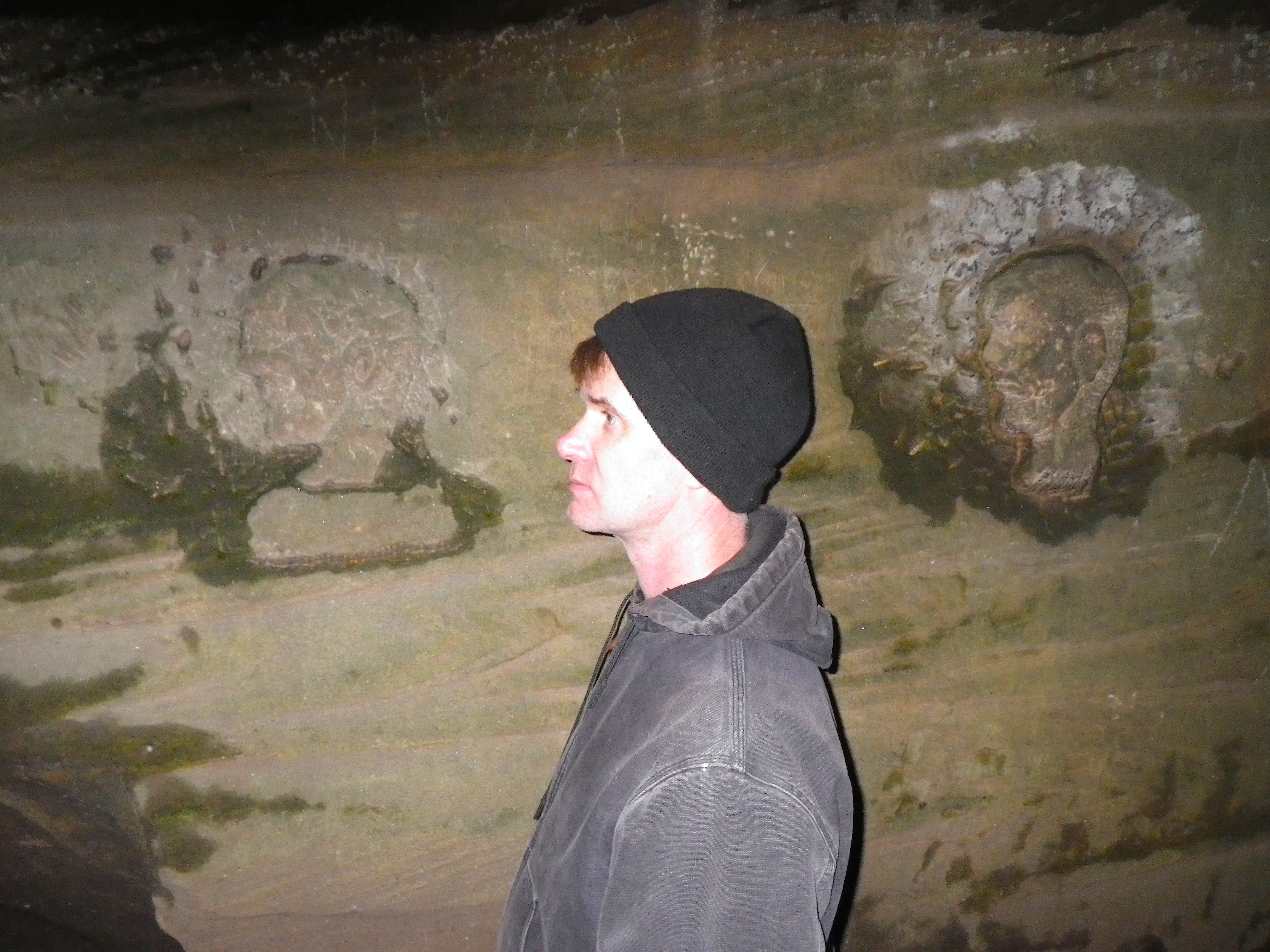
Life-sized head carvings!
Anyway, the crack was a lot of fun. It was narrow enough to put your feet across but we just could not figure out how to climb up the walls. There were a ton of foot and hand holds but it was so completely vertical that your center of gravity could never get close enough to the wall to haul your body upwards. We tried though.
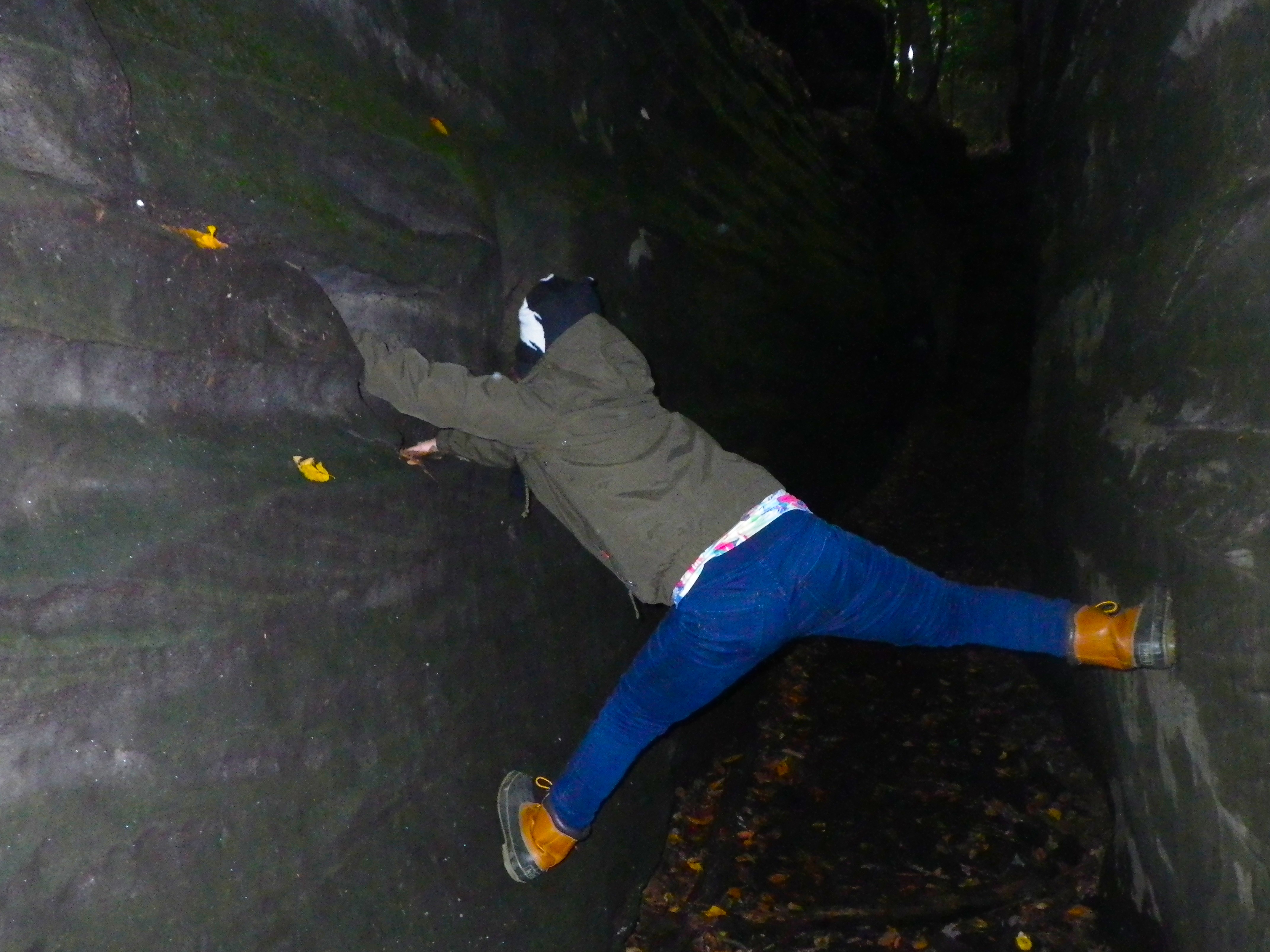
Me being graceful.
After the crack, there were a few other places where you could climb and have fun. But the trail just meanders alongside the cliff walls and never takes you through them. Cliffs are cool and all, but cracks are better.

It’s eating me!!!
Blurry, but still cool.

We’re all holding onto a wall, 6 feet up and attempting to take a selfie.
After the crack, the cool stuff starts to dwindle down until large, fallen rocks are the things to see. There’s some cool history stuff like an old horse cart and some steps with interactive signs. We had spent so much time in the crack that it was now getting pretty dark and we were getting pretty tired. The entire trail is about a mile and we thought we were almost done. When we saw the steps, however, we realized we weren’t even halfway there.
We were starting to get worried, but we saw all these signs for the Ledges Shelter, pointing down tiny trails that led into the woods. It wasn’t until later we realized they meant the freaking parking lot. Anyway, the thing we forgot and anyone hiking this trail should remember is that the parking lot is in the middle of this circular trail. You can cut it short by walking one of the many trails inward.
We finally did just that and proceeded to get lost because the trails crisscrossed with other trails and we actually found two small buildings randomly sitting in the woods (was this the Ledges Shelter?). We came upon a huge field and I spied cement through a break in the trees. I was convinced it was the parking lot but my mom wasn’t sure. My mother is a worrier but I can usually get her to do things by saying something along the lines of, “Let’s just check it out.”
We walked along the field and came across a mama deer and her two adolescent bucks. The bucks were playing, something I realized I had never actually seen before. I thought deer were always so serious, constantly worried about getting eaten but having to spend most of their time in the open so they themselves can eat. Harsh life, man.
The deer stopped playing when we got closer and we passed within 20 feet of them and into…the parking lot!! So we didn’t get to see the whole trail, but I doubt anything was cooler than that crack so I’m cool with it.
Camping
We don’t have any camping pictures. 1. It was pitch black and a flash in pitch black only lights up dust (and ghosts, apparently). 2. It was raining and FREEZING. 3. We had other important things to do like set up camp. So just get off my back, okay?
The camping here was interesting. There were only 5 campsites in all of Cuyahoga Valley National Park and they were all primitive. Reserving one was a nightmare because I couldn’t find an online system so I had to call Patricia. But Patricia was never in the freaking office so there was a lot of phone tag going on. Sometimes it was annoying; other times it was quaint. It depended on how I was feeling that day.
The campsite caters more to backpackers and less to people with cars. They wanted you to park at the visitors center, 0.5 miles away and walk up a skinny, hilly, busy, road with no streetlights. There were times when Cuyahoga Valley National Park acted more like the state park it so recently was and this was one of those times. They’re not quite equipped to handle a lot of out-of-towners yet. That being said, if you like adventure, you could probably spend an entire summer backpacking and biking the trails in this park. If you’re seeking more of a structured visit, this place might not yet be for you. It’s definitely the scrappiest national park I’ve been to yet.
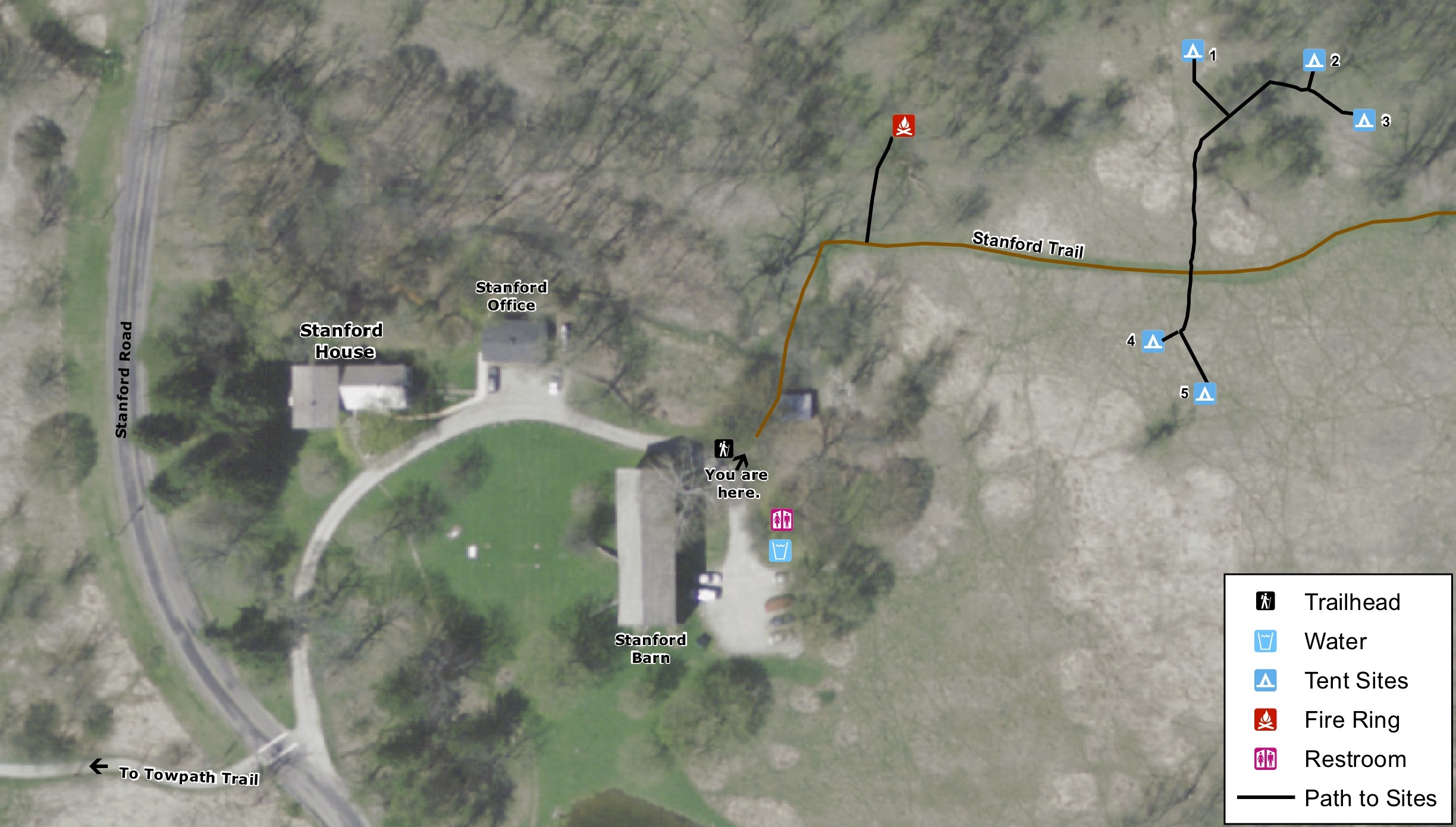
I put the address for the Stanford House into the GPS and we followed winding roads until we pulled into what looked like the driveway to a big house. We followed the driveway towards the back of the barn and parked next to two other cars. There was a small light near a port-a-potty (which did not smell and had hand sanitizer) and a huge water container. We were in the right place. But we couldn’t find the campsites. I found a shed full of wood next to a trail with a tiny sign that read Stanford Trail. There was one of those big displays you see at trail and landmark entrances but I just assumed it was for the Stanford Trail.
We walked up to the house and heard voices inside. They appeared to be complaining about something. All the doors were locked. I didn’t want to knock and ask for directions because it had to be here! There was a bathroom and water and wood! We had to be close. My dad got out the lantern and we read the sign. At the bottom, there was a map of the campsites. We WERE here.
Apparently we were supposed to take the Stanford Trail to our campsites. Geesh, they made us work for it, let me tell you. I like primitive campsites as much as the next guy but how hard is it to put up a sign that says ‘Campsites’ or light up the display with the map just a little bit? Because I cannot stress to you enough how freaking dark it was. The only light was above the port-a-potty and it was so tiny it was basically just a tiny beacon towards relief. It didn’t even light up the inside. The other light was from the Stanford House but all that did was blind you to the night instead of lighting it up.
Anyway, we followed the trail and, according to the display’s map (which I later found on their old conservancy website – not the national park one), we kept going to the right. Thank God for that map, otherwise, we never would have found it.
I have to describe the campground to you because it was honestly the COOLEST campground I’ve ever been to. It was just a field with weeds 7 feet tall that someone mowed a path through. The campsites were just tiny crop circles in the weeds. Even though our neighbor was 20 feet away, it felt completely private because you couldn’t see anything over the weeds. Ladies and gents, THIS IS HOW CAMPSITES SHOULD BE SET UP! (Albeit with more signage.)
It started raining when we set up the tent because of course. We had put all of our equipment in a plastic tote, which was bulky but also incredibly nice to have when it started raining. My dad and I set up camp and my mom lugged stuff from the car. Then my mom started cooking food (a quinoa meal pouch) while I laid out 10,000 sleeping bags inside the three person tent because my mom was convinced we were going to freeze to death.
The only thing that sucked about this campground was we were not allowed to have a fire at our site. There was another mowed off area where there was a shared fire. It’s not that I hate sharing, it’s just that we had to go someone else in order to get warm. After the food was done, we went to the fire and ate.
We decided to risk it with our car. Two other cars were parked behind the barn, you couldn’t see the cars from the main house, we were allowed to park there for 15 minutes to unload anyway, and I highly doubt someone would monitor behind the barn in the middle of the night. Nothing happened with the cars. I think they succeed in getting people to park at the visitors center through fear rather than enforcement. That being said, park at your own risk, people.
We crawled into our tent and passed out. We wore our clothes, including our hats, and just passed out. It’s amazing how exhausting being cold can be.
We woke up, ate breakfast (oatmeal), broke camp, and were on our way!
Brandywine Falls
The Internet also said we had to check out Brandywine Falls. My dad was disappointed because it was just water and said he was going to write a letter about false advertising.
Another thing about Cuyahoga Valley National Park is that you’ll need your map reading skills. The main road was next to the river. Most of the “attractions” were on the other side of the river. So we needed to go kind of far out of the way to get to stuff because we first had to find a bridge to take us over the water. To get to a lot of the stuff, we actually drove out of the park, down a little ways, and then back into it.

The gorgeous falls.
The waterfall was gorgeous. And it had really nice walkways and the fallen leaves made it stunning. But I’ve seen waterfalls. I’m not trying to sound jaded but Brandywine Falls didn’t really offer anything new to the table. We could have skipped it and spent more time on Ledges Trail.

Really cool, twisty paths.
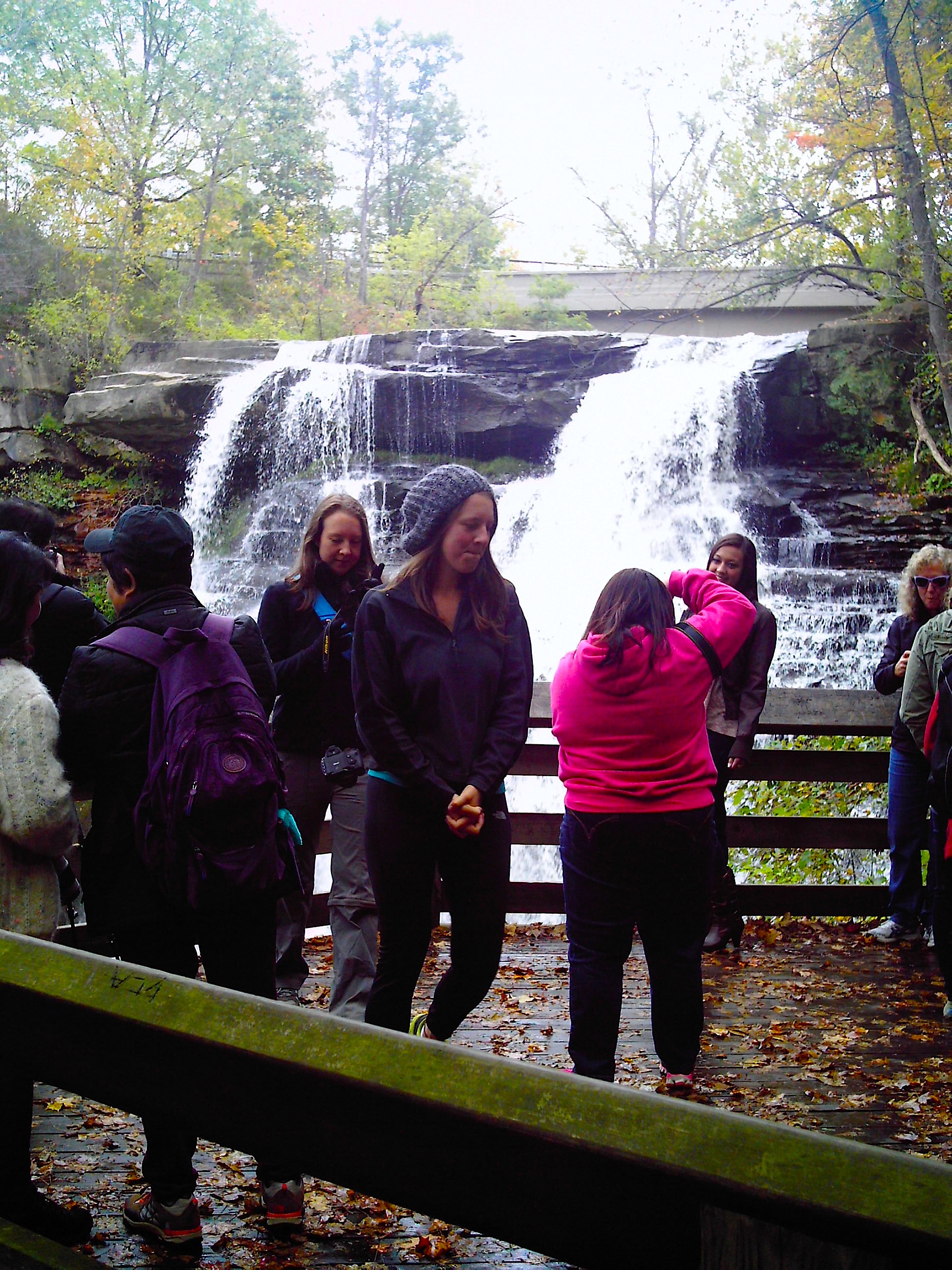
Soooo many people were taking pictures of themselves in front of the falls.
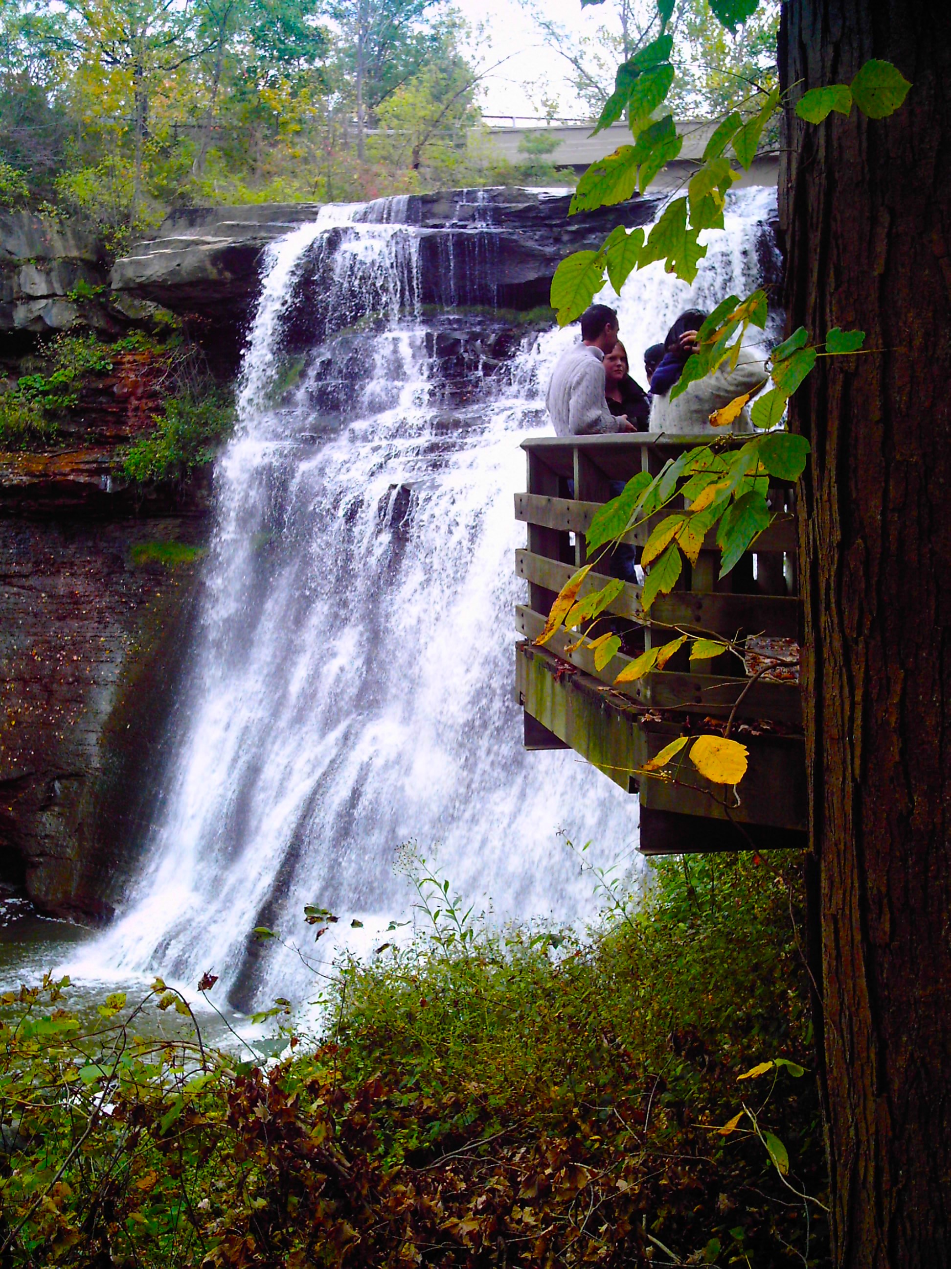
A cool balcony thingy.
There were a lot of people taking pictures in front of the falls. We felt like we had to do the same in case it was a tradition or something (EVERYONE was taking pictures of themselves in front of them). I yelled at my mom to take the picture quick because some lady was having massive intestinal distress and taking it out on all of us like it was our fault. I don’t know if she somehow felt protected by all the people but you could totally tell it was her. The smell just followed her. She was smiling a lot so I guess it made her feel better, which is nice and all, but she could have walked a little bit away from the group of people. I think Emily Post tried to write about that but then her publishers were all, what’s the etiquette on writing about bad etiquette and she just dropped it to make her life easier.

The lady next to me totally farted!
There was an old mill so we got our history lesson in for the day.

An old mill ruin.
The paths were cool because they used the natural rock walls. While this place might not be worth it to take a special trip out to visit, if I could build a house here I totally would.

Rock walls.
We walked all the way to the top of the falls and over a bridge. We saw some people who had walked to the other side of the falls though a small field. Probably to get away from the farting lady.

Top of the waterfall.
Towpath Trail
My mom loves to bike ride. Like it’s a sickness how much she likes it. My dad (and I, thanks to him) have bad knees so I was a little worried about biking 10+ miles. But as I learned on the train ride back by eavesdropping on a fellow passenger, if you bike from south to north, you are actually going downhill the entire time. That’s why they needed the locks system. HISTORY! So it was actually a decently easy bike ride.
Before we left, we picked up a train schedule at the visitors center. The Cuyahoga Valley National Park does this cool thing where you can bike one way and take the train back for $3 per person. The train goes up and down the tracks all day but pulls into stations along the way at certain times. We just had to make sure we were at one of those stations at a certain time. We were going to shoot for the Rockside Station at the end of the tracks but if we didn’t think we could make it, we could stop at an earlier station. Again, we were unaware of the downhill thing.

Biking the Towpath Trail
We started at the Boston Visitors Center and followed a sign to the Towpath Trail and we were off. Finally, some signage! The trail was well maintained but still rustic looking.

A heron. I bet this place is gorgeous in the fall and spring.

There were a lot of people on the trail, but it wasn’t crowded.
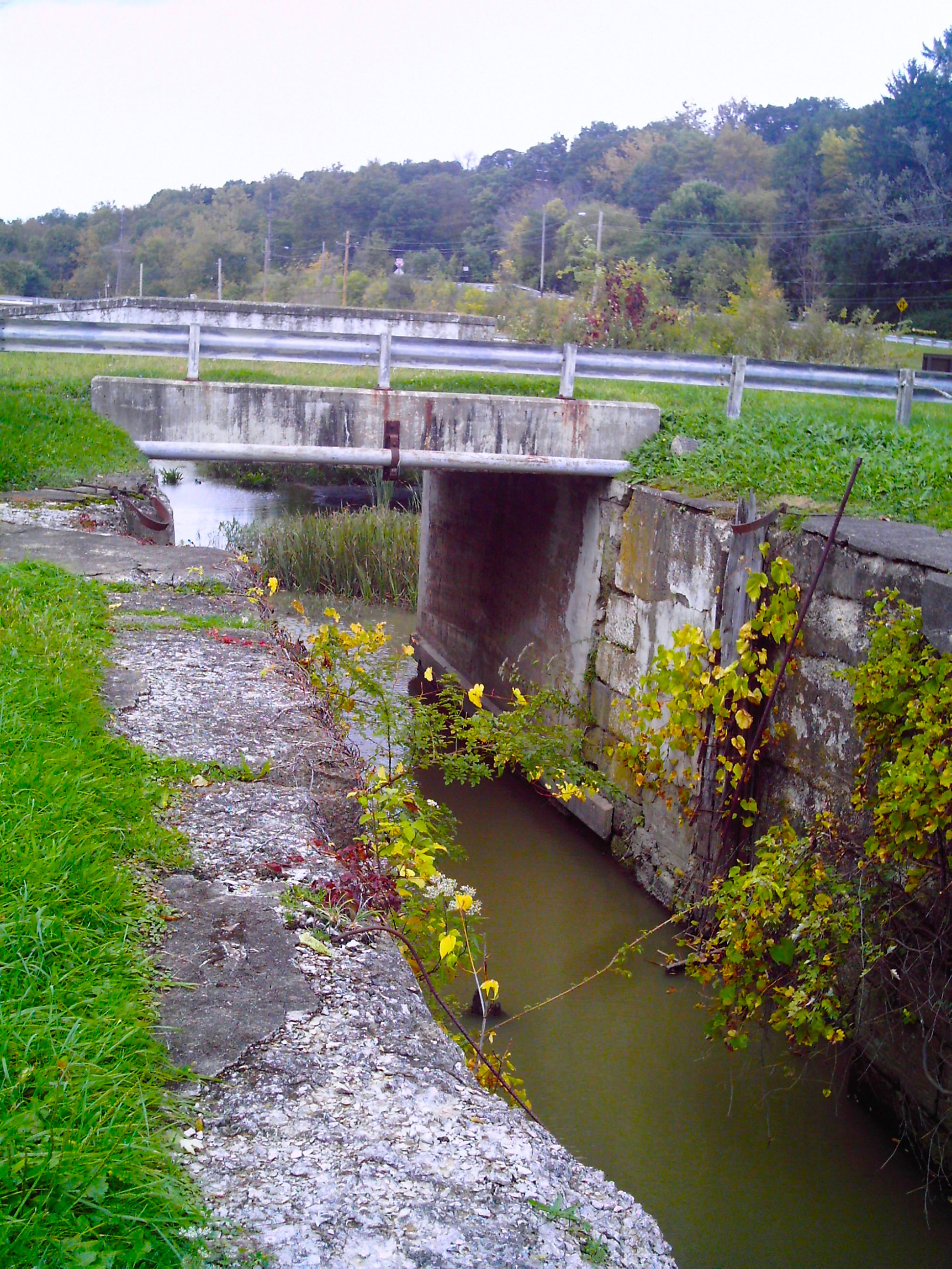
We came upon a lock! In the middle of a grass field? Miles later, we will be stopping at the Canal Exploration Center where they explain what the hell is going on here. But so you can enjoy the pictures, I will just explain it now.
In the time before railroads, boats were the best way to transport items. But the Cuyahoga River wasn’t the best to put boats on for some reason (I neglected to find out why, sorry). So the good people of Ohio built a canal next to the river, using the water from the Cuyahoga River. So that the canal didn’t have a current, they made the water level steady using a locks system. From one lock to another, the water level was the same. The boat would go into the lock, the water level would lower to the level equal from that lock to the next, and the boat would be on its way until it hit the next lock.
Now, I learned about locks in elementary school so I understood the basic stuff. But my mind was about to be blown in the Canal Exploration Center. Remember how we were biking the Towpath Trail? Well, the boats that used this canal were small and were more like rafts than anything. They didn’t have motors and, with no current, had to be towed down the canal. By donkeys. We were biking the trail that the donkeys used to tow the boats. So cool! (But I’m a nerd and I like stuff like that.)

A lock! Obviously not in commission anymore.
A map mentioned the Frazee House on the trail so I wanted to make sure we didn’t miss it because it was on the map and that means something, right? Well, there were like 5 signs along the way pointing to it so we didn’t have to worry about missing it (those people who handle the campground should check this area out).
But it was closed. We could see why pretty quickly. It was crooked. And bulging out. I didn’t know bricks could do that. They were renovating it so we couldn’t go inside. I’m sure if we could, we’d know why this house was on the map, because all I found out was it’s an old house that some guy built with the $300 he won in some lawsuit. Inflation, man.

The Frazee House was closed!

They were doing renovations.

The Frazee House looked like it was bulging out…
So we continued on our way. We saw some other cool things like this drawbridge thingy. Or this non-drawbridge thingy. There was no signage (it’s probably maintained by the campground people).
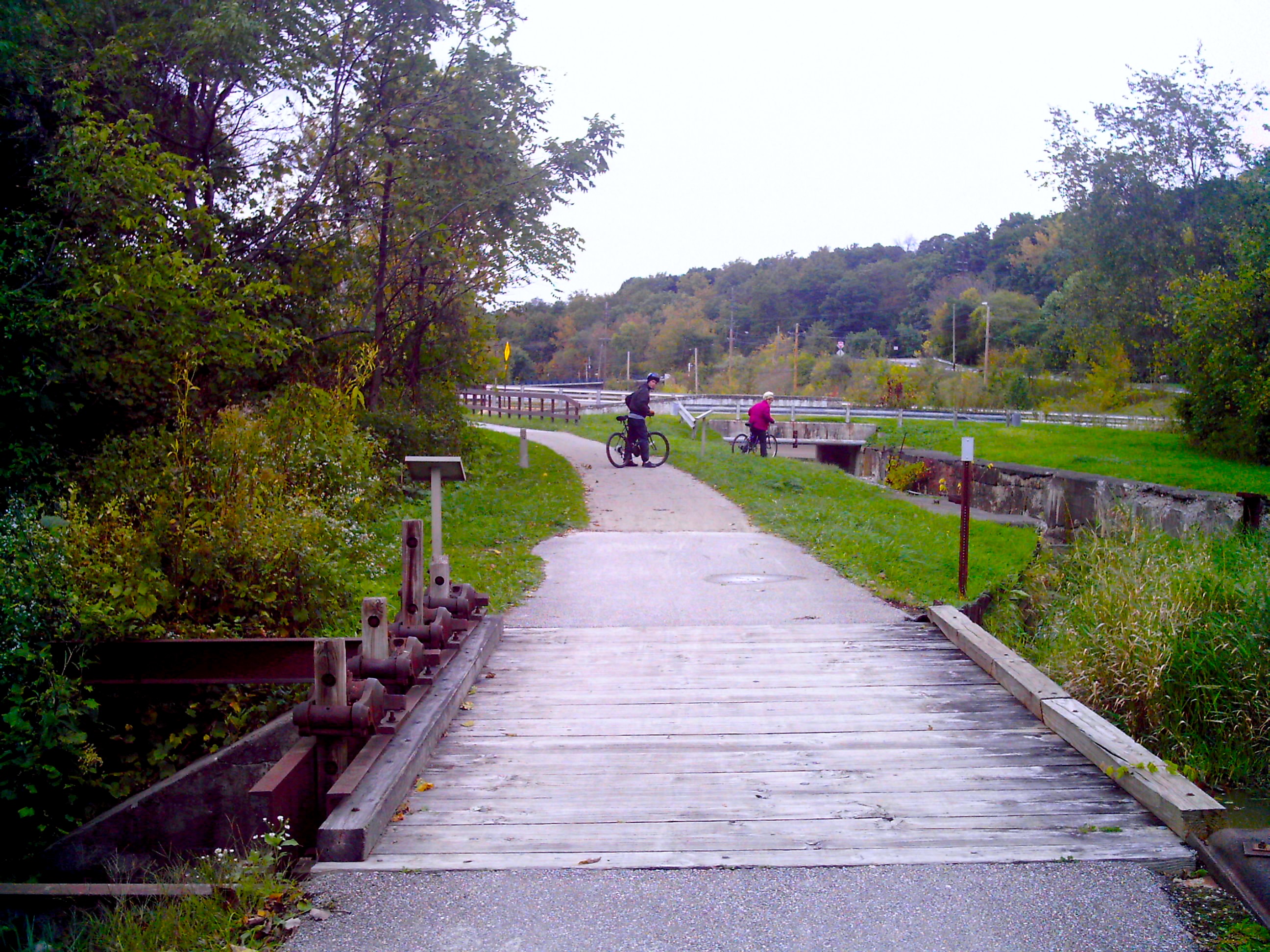
A drawbridge?

Why would it need to go up? Maybe it isn’t a drawbridge?
We came across this HUGE bridge that I really want to bungee jump off of. I’m putting this picture here, though, because right before this the path splits in two. We were really confused and took the straighter of the two paths. Turns out, it just meets back up after this bridge so there wasn’t any need to worry.
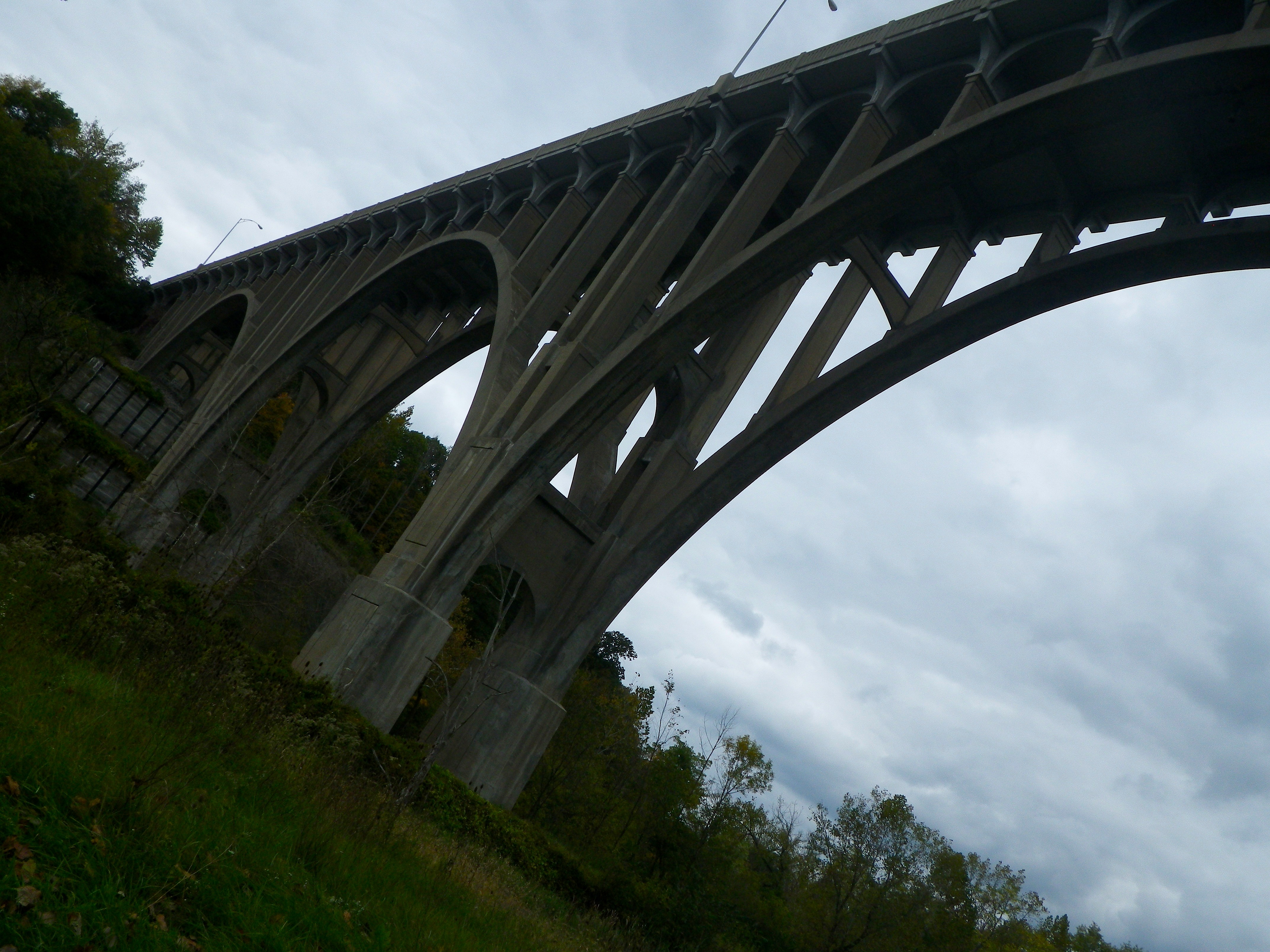
A cool bridge.
We saw more locks.
A lock? I’m not sure.
And old mills.

And old mill. There was a new one behind it – I like they kept the old one.
And this hilarious Simpsons reference.
I had to stop and take a picture of this Simpson’s reference.
Finally we came to the Canal Exploration Center and got to see a restored lock. It was kind of cool, actually. My dad went over and lifted a heavy metal thing out of a socket and totally almost opened the door. Then he couldn’t put it back. Using his strength and my vision, we finally got it back in before my mom could yell at us. We walked away whistling nonchalantly just in case.

Most definitely a lock. It was next to the Canal Visitors Center.
The inside was packed with information about canals and locks in general, and about northern Ohio. There was a video running on a loop upstairs that explains just about everything about why the canal was here and what happened to it. Spoiler alert: there was a huge storm that destroyed the canal (that’s why there are locks sitting in grassy fields) and, with railroads coming on the scene, it wasn’t worth it to rebuild.
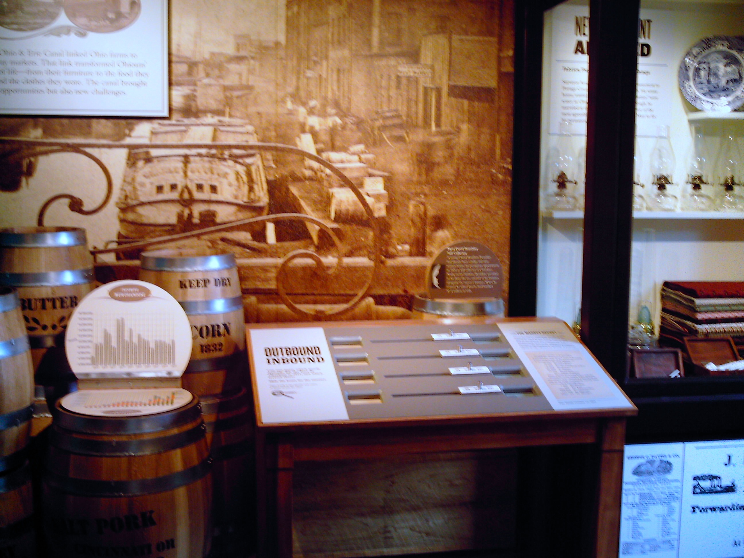
I learned soooo much at the Canal Visitors Center.
There was a video game where you had to get a boat through a lock. And it was hard. Like it took my mom and me a few tries. The point is to do it in as few steps as possible and no matter what I did, I always had one more step than necessary. My mom got it down to the right number, but I was watching her and I don’t think she did anything different than me. I’d say it was a scam but what did they get out of it except my not-so-subtle freak out on the security cameras?
Anyway, Rockside Station was just a mile or so ahead and we had plenty of time to get there so we spent a while at the Canal Exploration Center. There was a lot of information but it was less national and more state history. Again, the national park showing its youth.
You could try on period clothes in the Canal Visitors Center! I’m going to need this captain’s jacket.
Okay, Rockside Station. Now this is important because we blew past the station and ended up in town. See, the maps aren’t so great. We didn’t know we needed Rockside Station because right next to it was something called Thornburg Station.
We saw a HUGE building with Thornburg Station written on a pillar that thrust into the sky like a homing beacon. I latched on and peddled hard. Suddenly we were in a strip mall area. With cars and parking lots. And Thornburg Station claimed itself to be a restaurant. We rode around awhile, hoping to find a sign for the train but no luck. So we went back the way we came.
Basically what happened is we ignored all the tiny signs pointing us to the train station because we were distracted by the huge Thornburg Station sign. Congratulations you guys, very effective advertising.
Anyway, you turn off the path to the left and hit a parking lot. In the back is a tiny yellow building: Rockside Station.
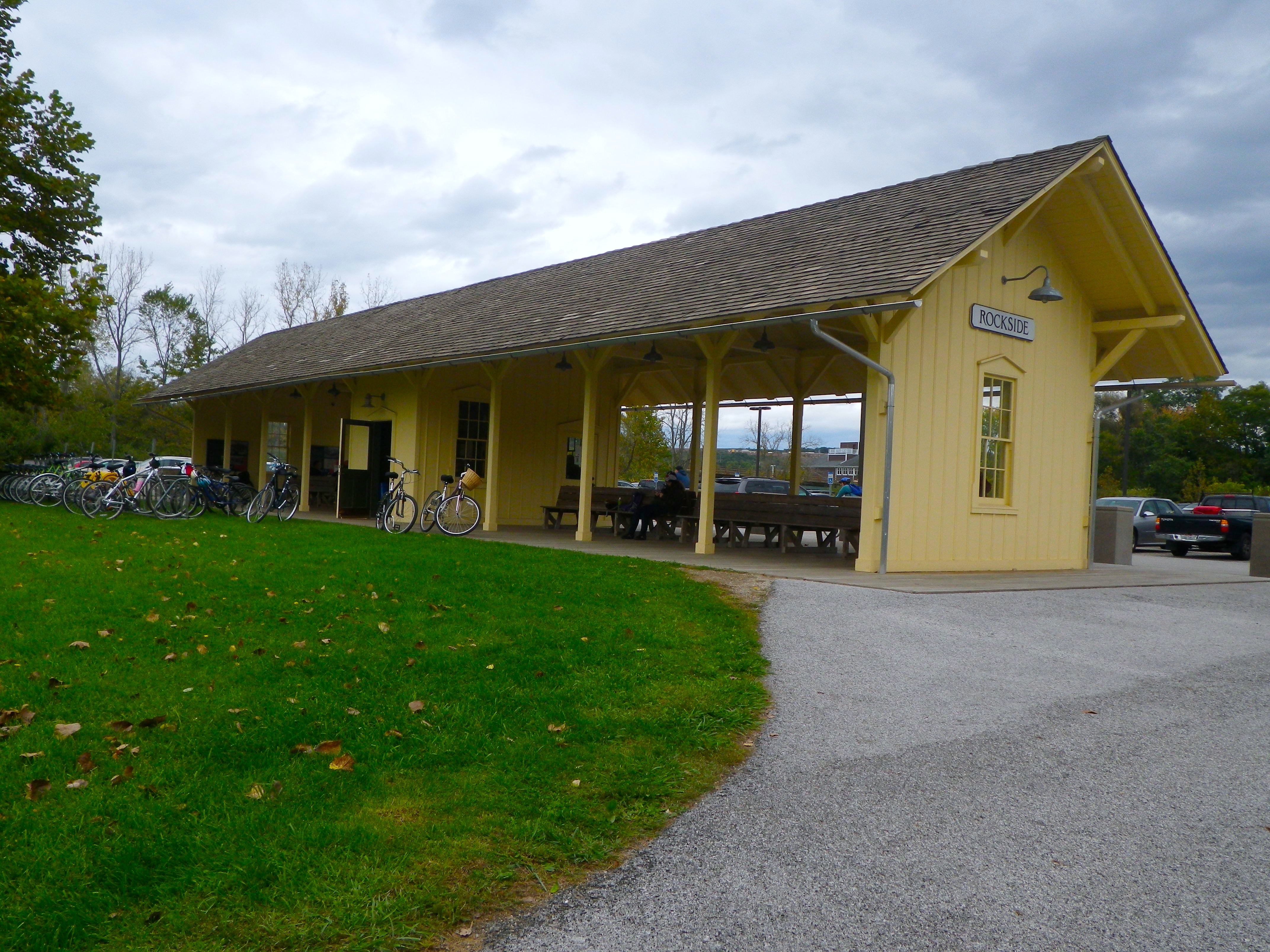
The train station.
We did it!
The inside was tiny and mostly for the rangers and desperate people who apparently NEEDED to plug in their phones. I’m not a fan of commercialization, but a gift shop would not be a bad thing. Especially if they had food. They’d probably make a killing.
You could rent bikes there so if you wanted to bike the Towpath Trail, you could park at Rockside Station, rent a bike, and then hop on the train to come back. The only problem is you’d be going uphill.
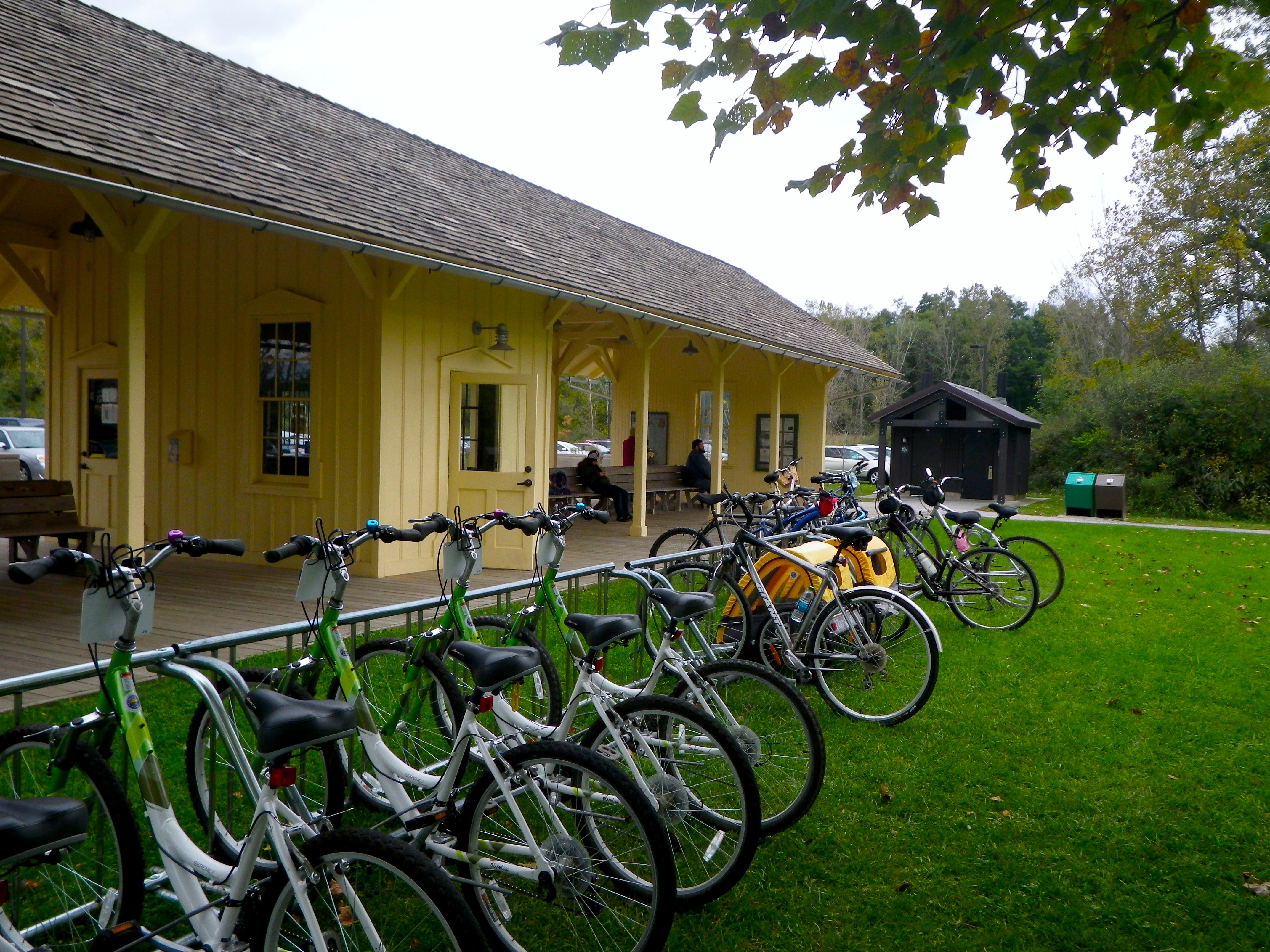
You could rent bikes there, too.
The train came! Now we were doing the Bike Aboard thing, which was the cheap option with no frills. The train has a lot more to offer, though. For around $20, you can get the whole train experience. You get food, the conductors are all dressed up, and there is a tour about what you’re seeing. We didn’t do that because we’re cheap bastards but it is definitely an option.
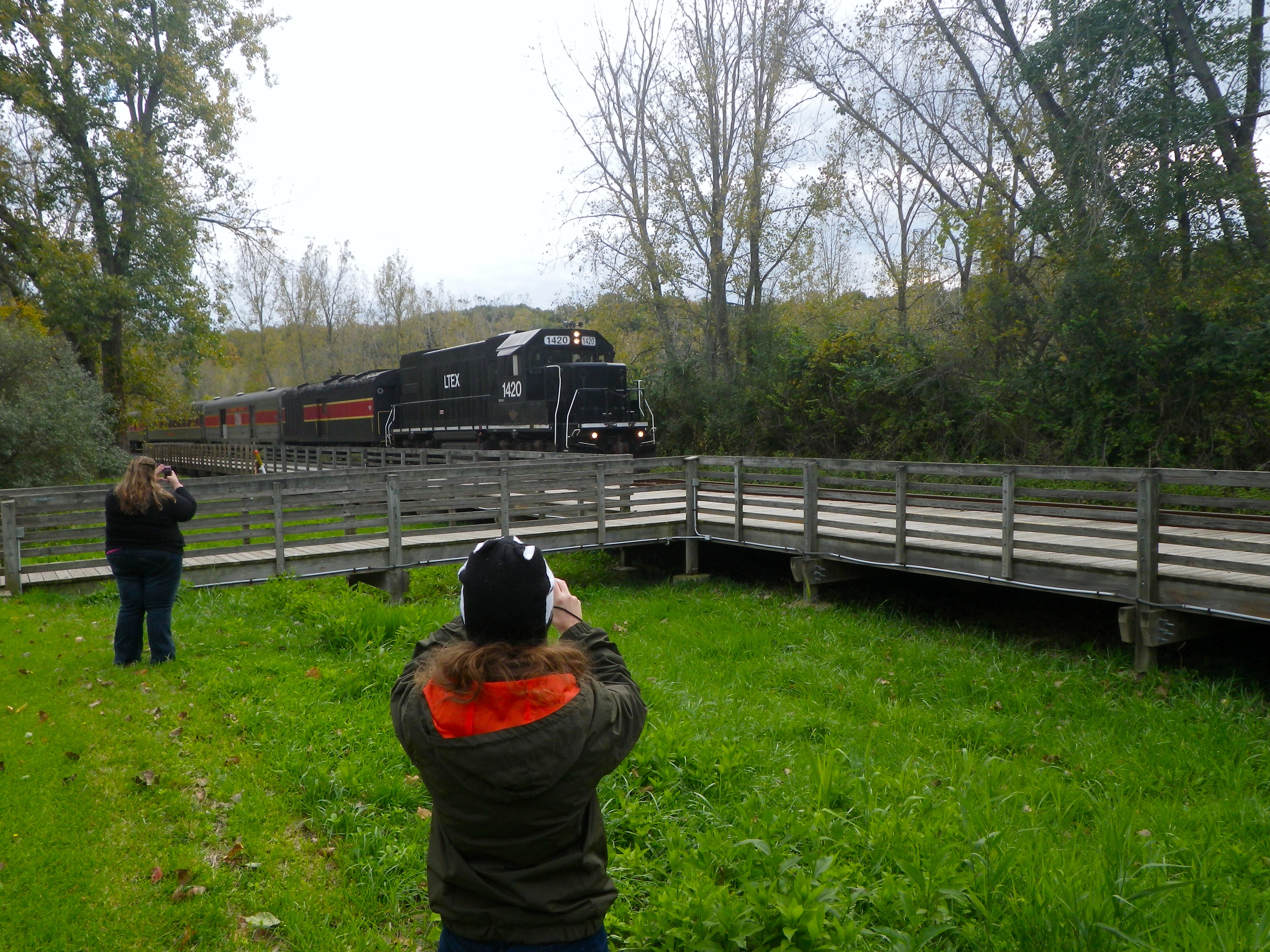
The train’s a-comin’!
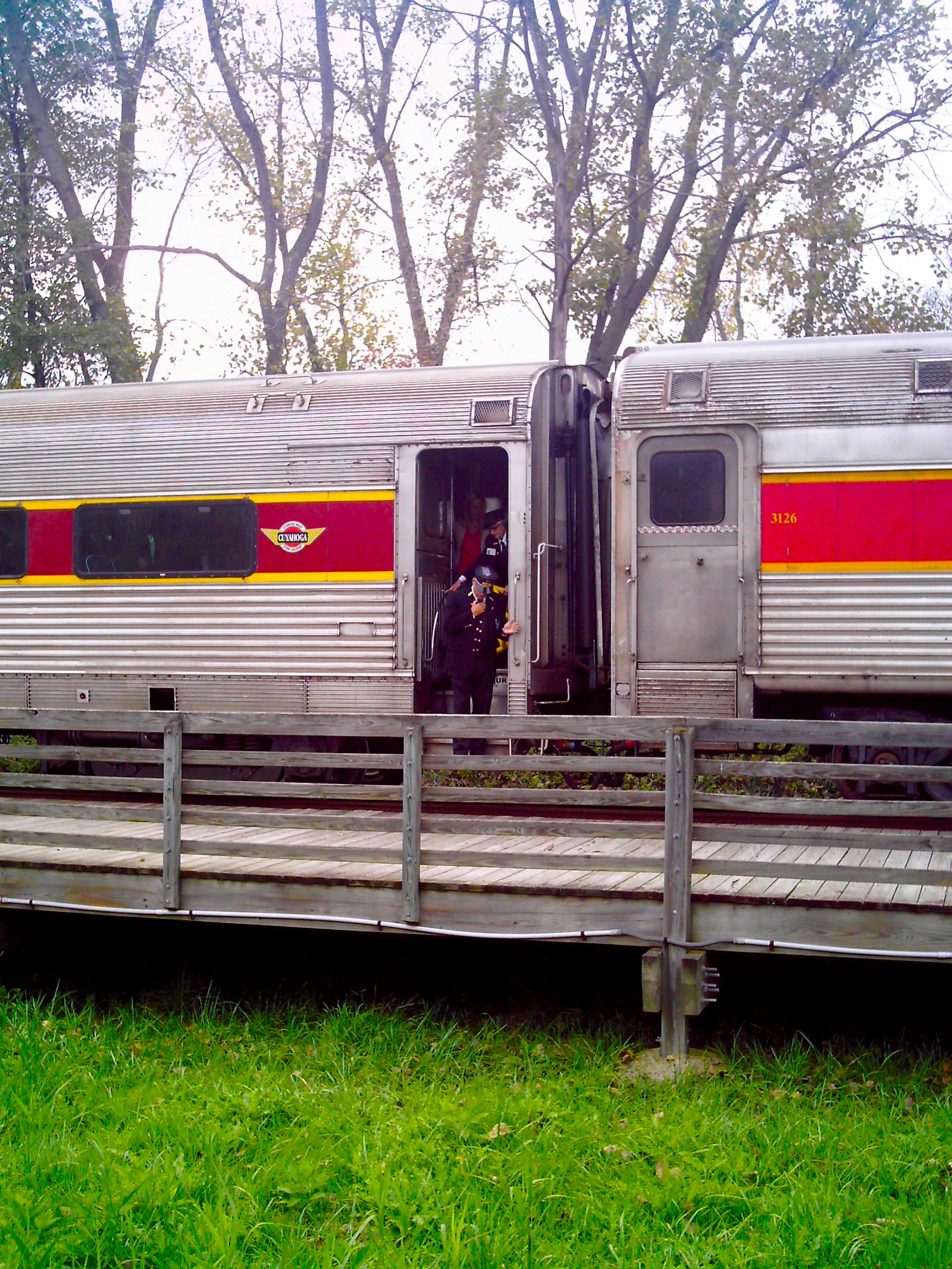
The train has uniformed conductors!
For us bikers, we had to go to the back of the train and hand our bikes up to the hoodie-clad teenagers. We told them what stop we were getting off and they put our bikes on rails in that stop’s section. Smart!
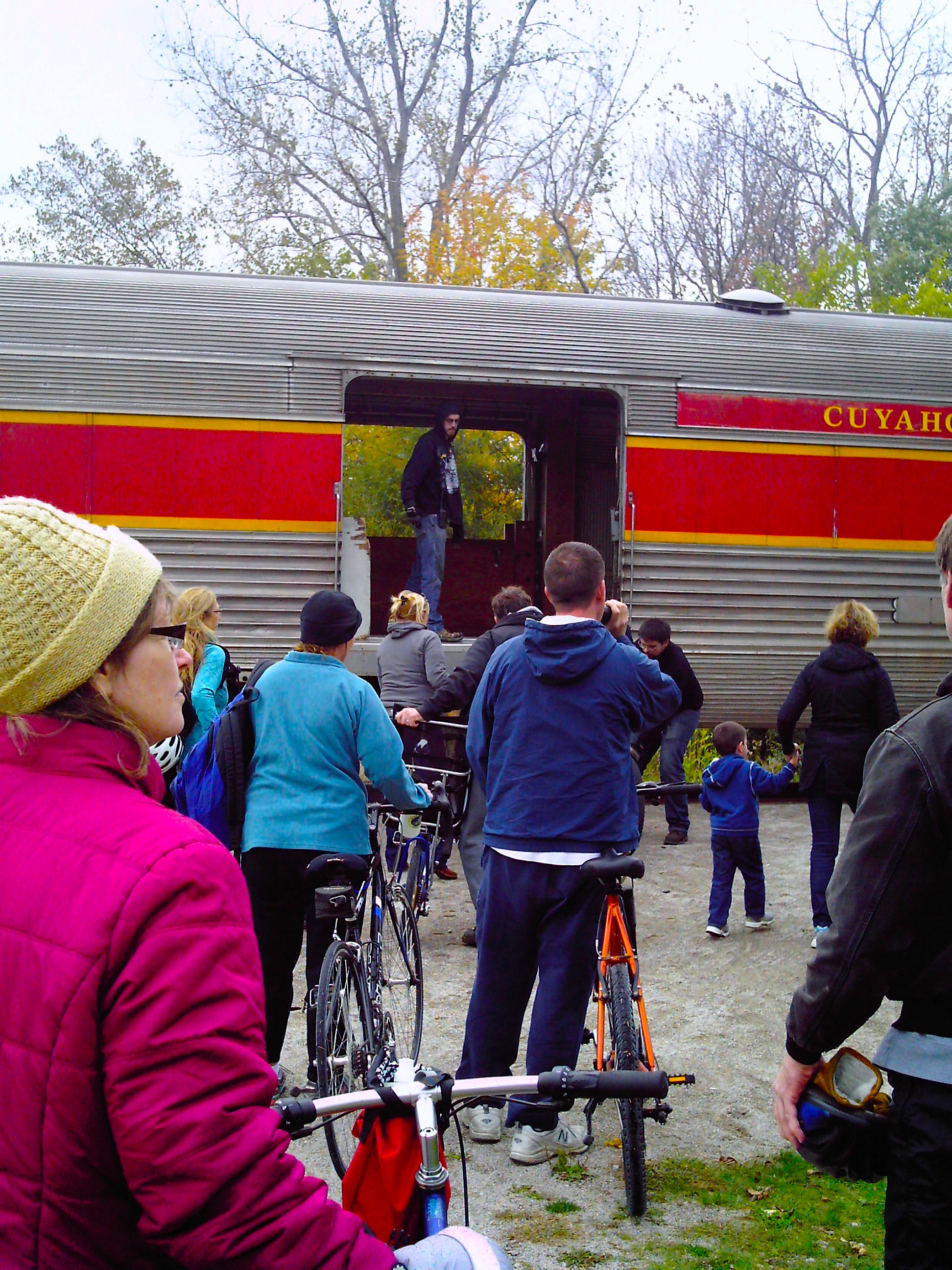
With the other bikers.
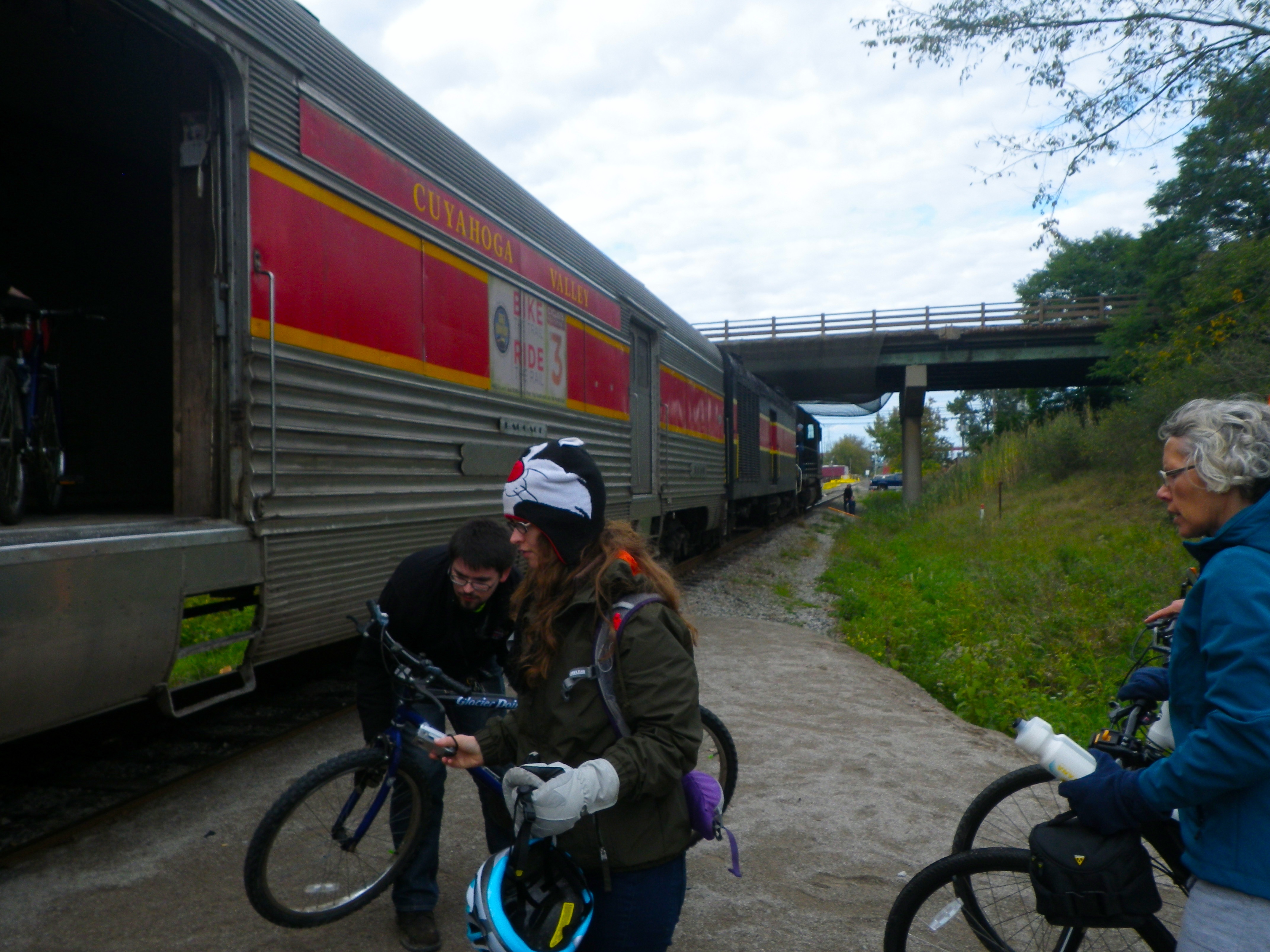
You told the guy where your stop was and they put your bike in a certain spot so they didn’t forget to stop the train for you.

Woooo!
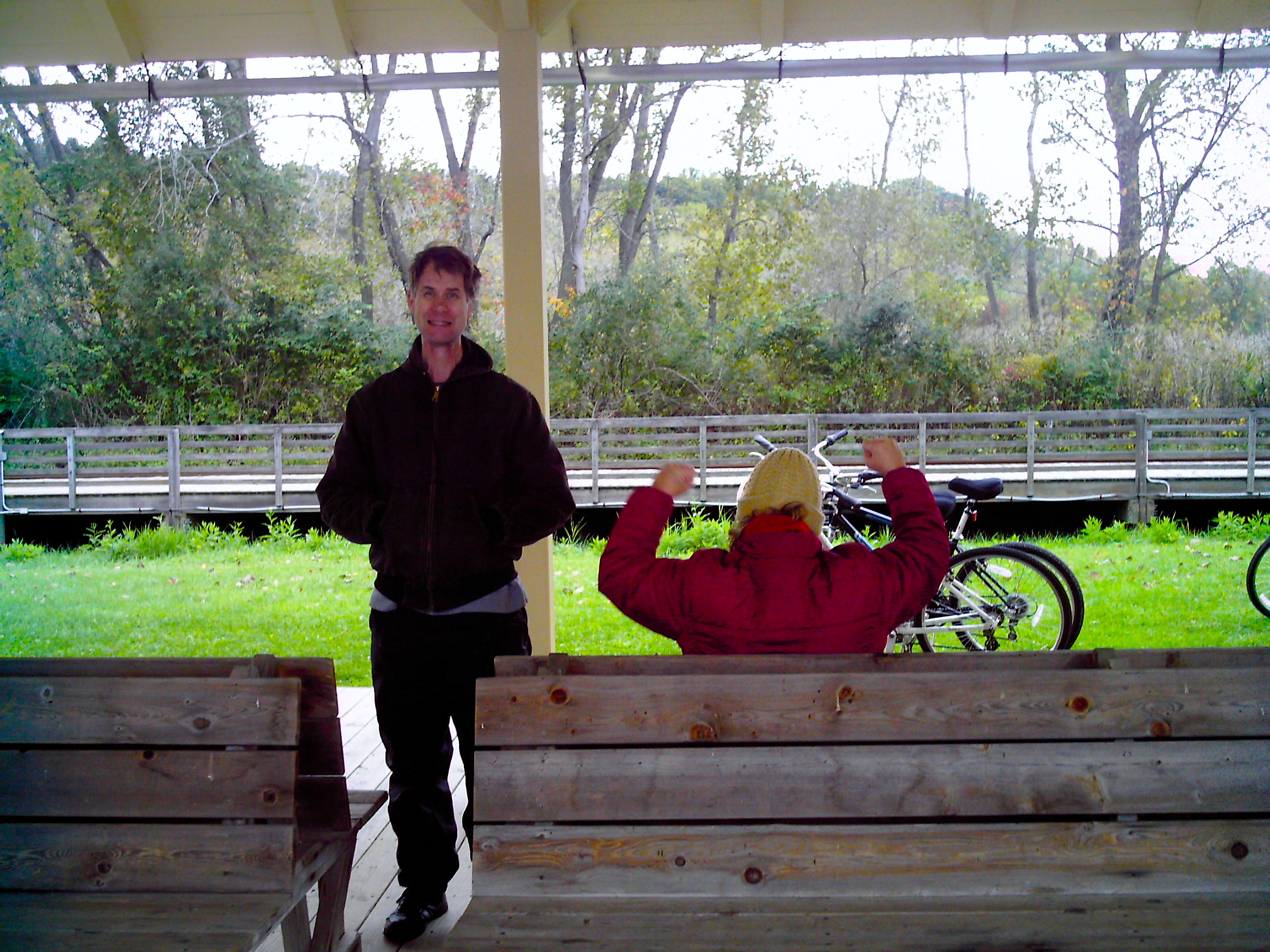
The train wasn’t anything fancy in the back but it was still kind of cool. There were clusters of four seats, two facing the other two, so it was good for conversation. We did have to listen to this one woman complain about everything though. Except it was more funny than annoying because we were exhausted and couldn’t muster up an emotion as strong as anger.

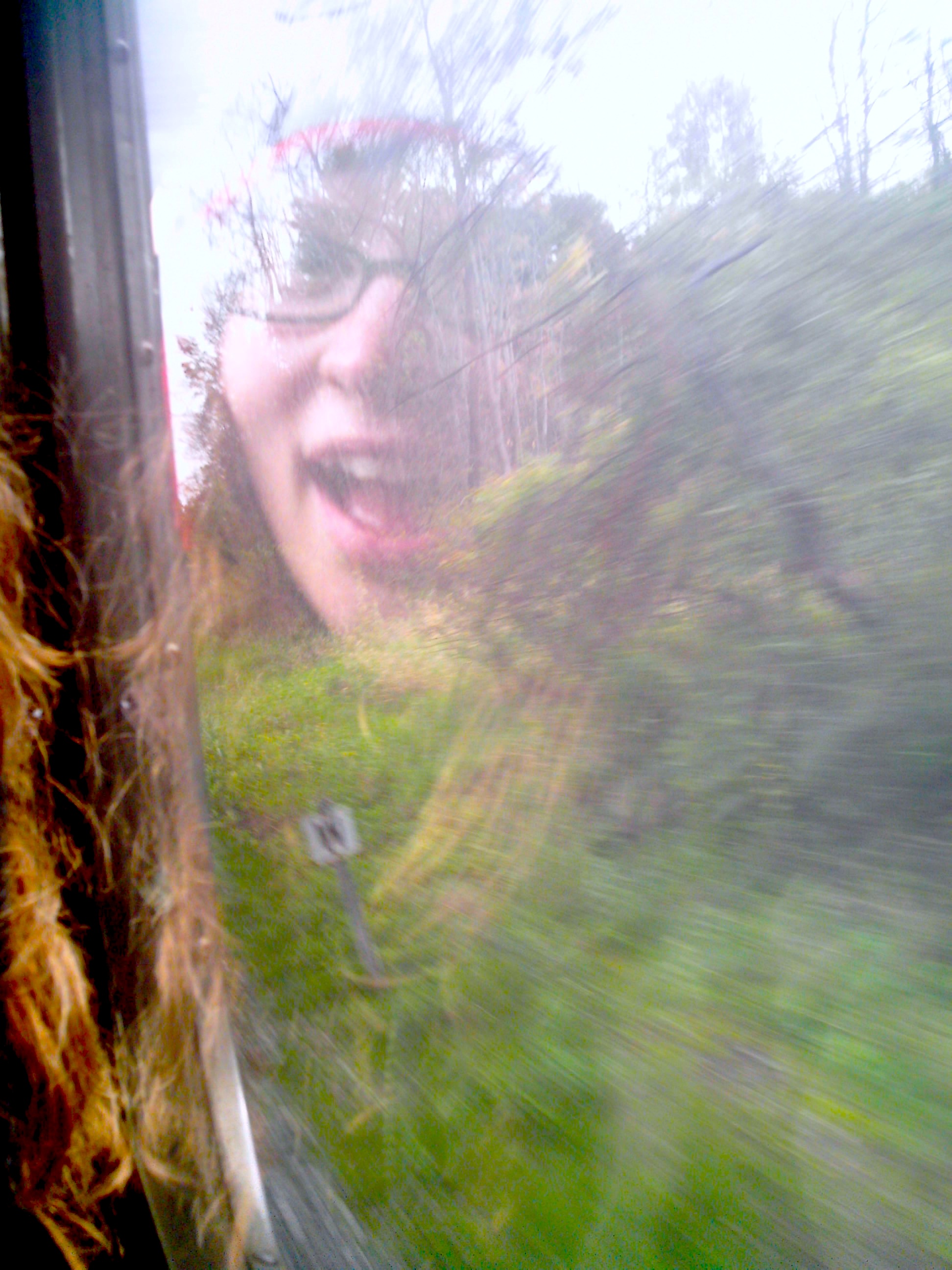
On the train.
We saw some things on the train that we didn’t see when we were biking, including a cool lake thing with stripped trees of which I neglected to get a picture. The trip to the Boston Visitors Center took like 10 minutes. Most people were getting off at the Peninsula Station about 2 miles down according to the conversations I was listening to. In fact, we were the only ones getting off at Boston Station. Weird.
This place was definitely an awesome state park but not quite yet an awesome national park. I’d wait a few years to come here if you live far away. The Ledges Trail was so cool but the Towpath Trail was actually the coolest. We saw a lot of people who were obviously biking and camping their way up the trail. The trail is actually very long, extending much farther south and north beyond the national park.
The coolest guy we saw had a bike loaded with second-hand gear, including an honest-to-God boombox bungeed to the front of his bike tuned in to the golden oldies.
The planning of this trip was one of the more difficult ones because there just wasn’t a lot of information and the information that was there was in all these random places. I mean, they have like 3 visitors centers and 10,000 side entrances! It looks like they are still transferring information from their old conservancy website to the government one, and the place is so big that the maps are really hard to read.
It’s definitely a work in progress but I think it’s going to be worth it.

Looks like a great adventure. I mean there are ghosts people!!!
LikeLike